KSA XW.KSA - Earthquake Result Viewer
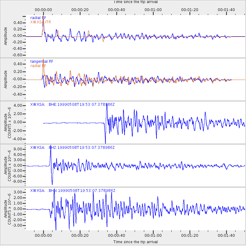
Earthquake location: Kuril Islands
Earthquake latitude/longitude: 45.4/151.6
Earthquake time(UTC): 1999/05/08 (128) 19:44:35 GMT
Earthquake Depth: 63 km
Earthquake Magnitude: 6.2 MB, 5.3 MS, 5.9 MW, 5.9 MW
Earthquake Catalog/Contributor: WHDF/NEIC
Network: XW Tien Shan Continental Dynamics
Station: KSA XW.KSA
Lat/Lon: 41.54 N/77.93 E
Elevation: 3398 m
Distance: 51.9 deg
Az: 293.646 deg
Baz: 59.206 deg
Ray Param: 0.06695638
Estimated Moho Depth: 45.25 km
Estimated Crust Vp/Vs: 2.00
Assumed Crust Vp: 6.491 km/s
Estimated Crust Vs: 3.254 km/s
Estimated Crust Poisson's Ratio: 0.33
Radial Match: 88.47077 %
Radial Bump: 400
Transverse Match: 82.51995 %
Transverse Bump: 400
SOD ConfigId: 4480
Insert Time: 2010-02-26 15:38:40.919 +0000
GWidth: 2.5
Max Bumps: 400
Tol: 0.001

Signal To Noise

ChannelStoNSTALTA
XW:KSA: :BHZ:19990508T19:53:07.378986Z99.323433.7774698E-63.8032013E-8
XW:KSA: :BHN:19990508T19:53:07.378986Z11.3159024.6199784E-74.082731E-8
XW:KSA: :BHE:19990508T19:53:07.378986Z37.629021.6872278E-64.4838476E-8
Arrivals
Ps7.3 SECOND
PpPs20 SECOND
PsPs/PpSs27 SECOND