You are here: Home > Network List > US - United States National Seismic Network Stations List
> Station CBKS Cedar Bluff, Kansas, USA > Earthquake Result Viewer
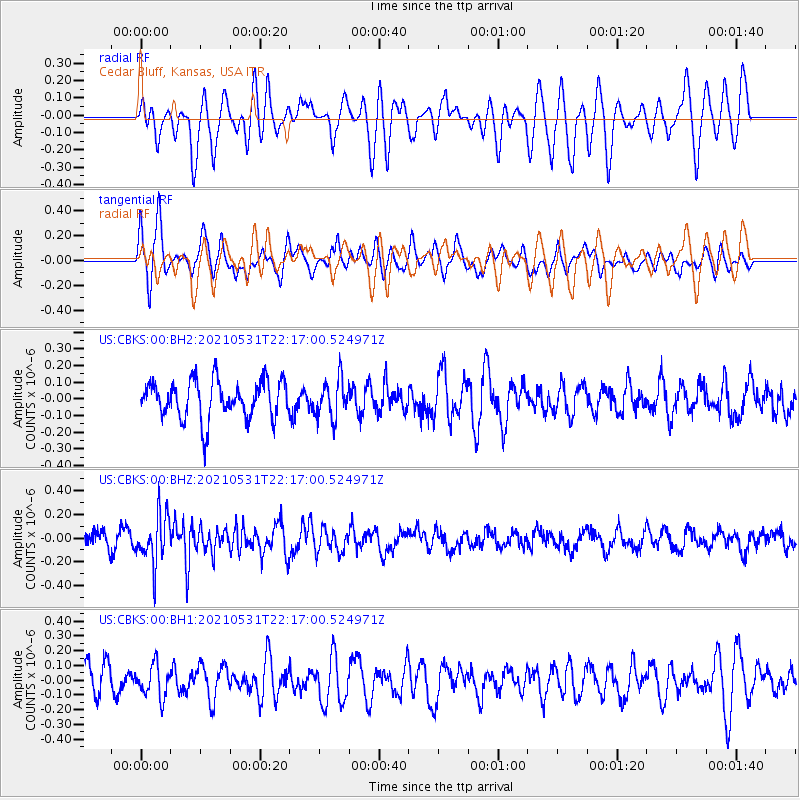
CBKS Cedar Bluff, Kansas, USA - Earthquake Result Viewer
*The percent match for this event was below the threshold and hence no stack was calculated.
| Earthquake location: |
Off East Coast Of Honshu, Japan |
| Earthquake latitude/longitude: |
33.2/142.7 |
| Earthquake time(UTC): |
2021/05/31 (151) 22:04:42 GMT |
| Earthquake Depth: |
10 km |
| Earthquake Magnitude: |
5.2 Mww |
| Earthquake Catalog/Contributor: |
NEIC PDE/us |
|
| Network: |
US United States National Seismic Network |
| Station: |
CBKS Cedar Bluff, Kansas, USA |
| Lat/Lon: |
38.81 N/99.74 W |
| Elevation: |
677 m |
|
| Distance: |
87.9 deg |
| Az: |
43.857 deg |
| Baz: |
311.94 deg |
| Ray Param: |
$rayparam |
*The percent match for this event was below the threshold and hence was not used in the summary stack. |
|
| Radial Match: |
62.50964 % |
| Radial Bump: |
400 |
| Transverse Match: |
52.60061 % |
| Transverse Bump: |
400 |
| SOD ConfigId: |
25028951 |
| Insert Time: |
2021-06-14 22:23:49.072 +0000 |
| GWidth: |
2.5 |
| Max Bumps: |
400 |
| Tol: |
0.001 |
|
Signal To Noise
| Channel | StoN | STA | LTA |
| US:CBKS:00:BHZ:20210531T22:17:00.524971Z | 2.4451683 | 2.0330404E-7 | 8.314522E-8 |
| US:CBKS:00:BH1:20210531T22:17:00.524971Z | 1.0849336 | 1.07499694E-7 | 9.908412E-8 |
| US:CBKS:00:BH2:20210531T22:17:00.524971Z | 1.0081707 | 1.15033345E-7 | 1.1410105E-7 |
| Arrivals |
| Ps | |
| PpPs | |
| PsPs/PpSs | |


