You are here: Home > Network List > US - United States National Seismic Network Stations List
> Station MNTX Cornudas Mountains, Texas, USA > Earthquake Result Viewer
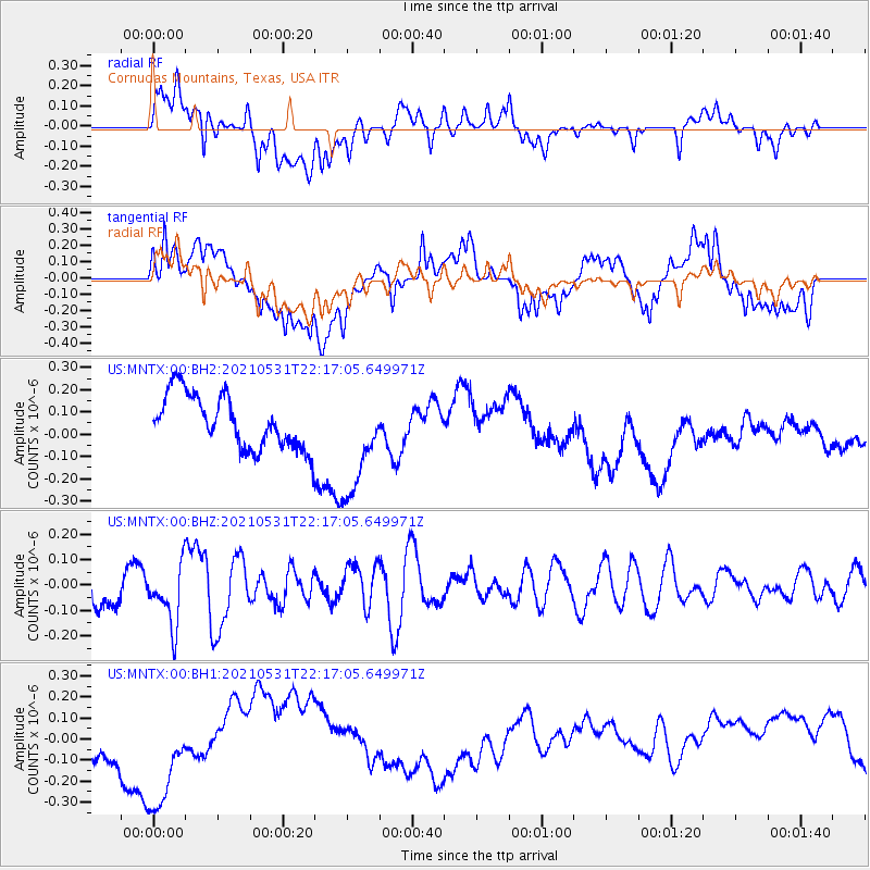
MNTX Cornudas Mountains, Texas, USA - Earthquake Result Viewer
*The percent match for this event was below the threshold and hence no stack was calculated.
| Earthquake location: |
Off East Coast Of Honshu, Japan |
| Earthquake latitude/longitude: |
33.2/142.7 |
| Earthquake time(UTC): |
2021/05/31 (151) 22:04:42 GMT |
| Earthquake Depth: |
10 km |
| Earthquake Magnitude: |
5.2 Mww |
| Earthquake Catalog/Contributor: |
NEIC PDE/us |
|
| Network: |
US United States National Seismic Network |
| Station: |
MNTX Cornudas Mountains, Texas, USA |
| Lat/Lon: |
31.70 N/105.38 W |
| Elevation: |
404 m |
|
| Distance: |
89.0 deg |
| Az: |
52.257 deg |
| Baz: |
308.916 deg |
| Ray Param: |
$rayparam |
*The percent match for this event was below the threshold and hence was not used in the summary stack. |
|
| Radial Match: |
23.381655 % |
| Radial Bump: |
400 |
| Transverse Match: |
13.01044 % |
| Transverse Bump: |
400 |
| SOD ConfigId: |
25028951 |
| Insert Time: |
2021-06-14 22:24:08.710 +0000 |
| GWidth: |
2.5 |
| Max Bumps: |
400 |
| Tol: |
0.001 |
|
Signal To Noise
| Channel | StoN | STA | LTA |
| US:MNTX:00:BHZ:20210531T22:17:05.649971Z | 1.8535453 | 1.1812732E-7 | 6.3730475E-8 |
| US:MNTX:00:BH1:20210531T22:17:05.649971Z | 2.3986337 | 3.15321E-7 | 1.3145858E-7 |
| US:MNTX:00:BH2:20210531T22:17:05.649971Z | 2.0269656 | 2.4299933E-7 | 1.198833E-7 |
| Arrivals |
| Ps | |
| PpPs | |
| PsPs/PpSs | |


