You are here: Home > Network List > GS - US Geological Survey Networks Stations List
> Station KAN13 Rinehart Farm > Earthquake Result Viewer
KAN13 Rinehart Farm - Earthquake Result Viewer
*The percent match for this event was below the threshold and hence no stack was calculated.
| Earthquake location: |
Tonga Islands |
| Earthquake latitude/longitude: |
-16.1/-174.0 |
| Earthquake time(UTC): |
2017/12/08 (342) 23:42:09 GMT |
| Earthquake Depth: |
117 km |
| Earthquake Magnitude: |
5.7 mb |
| Earthquake Catalog/Contributor: |
NEIC PDE/us |
|
| Network: |
GS US Geological Survey Networks |
| Station: |
KAN13 Rinehart Farm |
| Lat/Lon: |
37.01 N/97.48 W |
| Elevation: |
340 m |
|
| Distance: |
89.2 deg |
| Az: |
51.109 deg |
| Baz: |
249.166 deg |
| Ray Param: |
$rayparam |
*The percent match for this event was below the threshold and hence was not used in the summary stack. |
|
| Radial Match: |
22.97372 % |
| Radial Bump: |
400 |
| Transverse Match: |
48.337566 % |
| Transverse Bump: |
400 |
| SOD ConfigId: |
2429771 |
| Insert Time: |
2017-12-22 23:43:45.201 +0000 |
| GWidth: |
2.5 |
| Max Bumps: |
400 |
| Tol: |
0.001 |
|
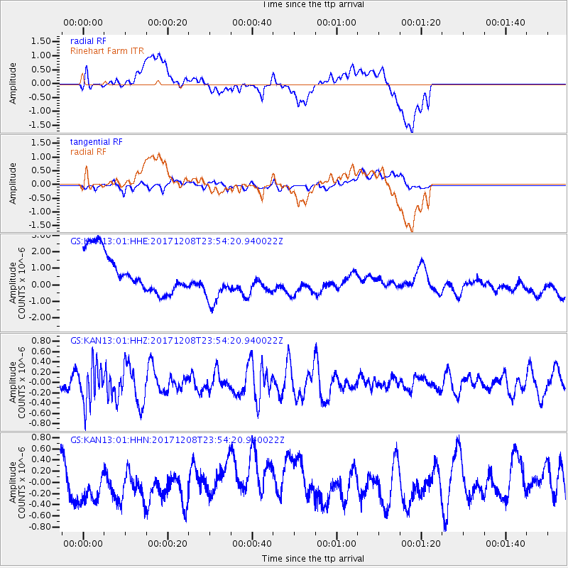
Signal To Noise
| Channel | StoN | STA | LTA |
| GS:KAN13:01:HHZ:20171208T23:54:20.940022Z | 1.6077443 | 3.5939343E-7 | 2.2353892E-7 |
| GS:KAN13:01:HHN:20171208T23:54:20.940022Z | 0.83878744 | 4.290331E-7 | 5.1149203E-7 |
| GS:KAN13:01:HHE:20171208T23:54:20.940022Z | 1.2369298 | 1.448371E-6 | 1.1709403E-6 |
| Arrivals |
| Ps | |
| PpPs | |
| PsPs/PpSs | |


