You are here: Home > Network List > US - United States National Seismic Network Stations List
> Station MSO Missoula, Montana, USA > Earthquake Result Viewer
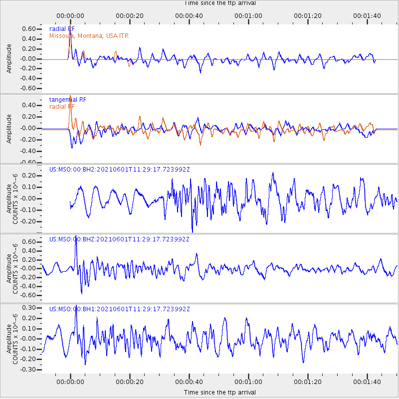
MSO Missoula, Montana, USA - Earthquake Result Viewer
*The percent match for this event was below the threshold and hence no stack was calculated.
| Earthquake location: |
South Of Panama |
| Earthquake latitude/longitude: |
5.0/-82.7 |
| Earthquake time(UTC): |
2021/06/01 (152) 11:20:57 GMT |
| Earthquake Depth: |
10 km |
| Earthquake Magnitude: |
5.5 mww |
| Earthquake Catalog/Contributor: |
NEIC PDE/us |
|
| Network: |
US United States National Seismic Network |
| Station: |
MSO Missoula, Montana, USA |
| Lat/Lon: |
46.83 N/113.94 W |
| Elevation: |
1264 m |
|
| Distance: |
49.6 deg |
| Az: |
332.118 deg |
| Baz: |
137.274 deg |
| Ray Param: |
$rayparam |
*The percent match for this event was below the threshold and hence was not used in the summary stack. |
|
| Radial Match: |
70.500145 % |
| Radial Bump: |
400 |
| Transverse Match: |
53.735455 % |
| Transverse Bump: |
400 |
| SOD ConfigId: |
25028951 |
| Insert Time: |
2021-06-15 11:48:05.246 +0000 |
| GWidth: |
2.5 |
| Max Bumps: |
400 |
| Tol: |
0.001 |
|
Signal To Noise
| Channel | StoN | STA | LTA |
| US:MSO:00:BHZ:20210601T11:29:17.723992Z | 3.0635252 | 2.5722971E-7 | 8.3965276E-8 |
| US:MSO:00:BH1:20210601T11:29:17.723992Z | 2.1175764 | 1.1945652E-7 | 5.6411906E-8 |
| US:MSO:00:BH2:20210601T11:29:17.723992Z | 0.99791396 | 6.940922E-8 | 6.955431E-8 |
| Arrivals |
| Ps | |
| PpPs | |
| PsPs/PpSs | |


