CHK Chkalovo, Kazakstan - Earthquake Result Viewer
Earthquake location: Southwestern Ryukyu Isl., Japan
Earthquake latitude/longitude: 25.0/125.8
Earthquake time(UTC): 1997/08/13 (225) 04:45:04 GMT
Earthquake Depth: 55 km
Earthquake Magnitude: 6.0 MB, 5.6 MS, 6.1 UNKNOWN, 6.1 MW
Earthquake Catalog/Contributor: WHDF/NEIC
Network: KZ Kazakhstan Network
Station: CHK Chkalovo, Kazakstan
Lat/Lon: 53.68 N/70.62 E
Elevation: 120 m
Distance: 49.7 deg
Az: 320.205 deg
Baz: 102.591 deg
Ray Param: 0.06837873
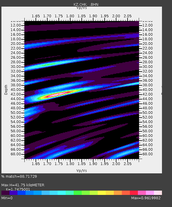
Estimated Moho Depth: 41.75 km
Estimated Crust Vp/Vs: 1.75
Assumed Crust Vp: 6.552 km/s
Estimated Crust Vs: 3.75 km/s
Estimated Crust Poisson's Ratio: 0.26
Radial Match: 88.71729 %
Radial Bump: 400
Transverse Match: 81.49939 %
Transverse Bump: 400
SOD ConfigId: 6273
Insert Time: 2010-03-09 08:55:56.855 +0000
GWidth: 2.5
Max Bumps: 400
Tol: 0.001

Signal To Noise

ChannelStoNSTALTA
KZ:CHK: :BHN:19970813T04:53:20.871014Z6.01266052.2283197E-73.706046E-8
KZ:CHK: :BHE:19970813T04:53:20.871014Z8.2777751.1053016E-61.3352643E-7
KZ:CHK: :BHZ:19970813T04:53:20.871014Z42.1198652.0288783E-64.8169156E-8
Arrivals
Ps5.1 SECOND
PpPs16 SECOND
PsPs/PpSs22 SECOND