You are here: Home > Network List > US - United States National Seismic Network Stations List
> Station AMTX Amarillo, Texas, USA > Earthquake Result Viewer
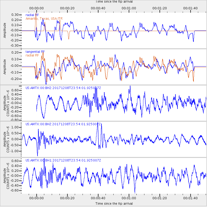
AMTX Amarillo, Texas, USA - Earthquake Result Viewer
*The percent match for this event was below the threshold and hence no stack was calculated.
| Earthquake location: |
Tonga Islands |
| Earthquake latitude/longitude: |
-16.1/-174.0 |
| Earthquake time(UTC): |
2017/12/08 (342) 23:42:09 GMT |
| Earthquake Depth: |
117 km |
| Earthquake Magnitude: |
5.7 mb |
| Earthquake Catalog/Contributor: |
NEIC PDE/us |
|
| Network: |
US United States National Seismic Network |
| Station: |
AMTX Amarillo, Texas, USA |
| Lat/Lon: |
34.53 N/101.41 W |
| Elevation: |
1010 m |
|
| Distance: |
85.3 deg |
| Az: |
52.212 deg |
| Baz: |
246.93 deg |
| Ray Param: |
$rayparam |
*The percent match for this event was below the threshold and hence was not used in the summary stack. |
|
| Radial Match: |
50.221645 % |
| Radial Bump: |
400 |
| Transverse Match: |
43.84105 % |
| Transverse Bump: |
400 |
| SOD ConfigId: |
2429771 |
| Insert Time: |
2017-12-22 23:46:15.726 +0000 |
| GWidth: |
2.5 |
| Max Bumps: |
400 |
| Tol: |
0.001 |
|
Signal To Noise
| Channel | StoN | STA | LTA |
| US:AMTX:00:BHZ:20171208T23:54:01.925007Z | 2.3675053 | 5.3579316E-7 | 2.263113E-7 |
| US:AMTX:00:BH1:20171208T23:54:01.925007Z | 1.1140735 | 2.2009917E-7 | 1.9756251E-7 |
| US:AMTX:00:BH2:20171208T23:54:01.925007Z | 0.98159504 | 2.6327703E-7 | 2.6821348E-7 |
| Arrivals |
| Ps | |
| PpPs | |
| PsPs/PpSs | |


