You are here: Home > Network List > US - United States National Seismic Network Stations List
> Station BOZ Bozeman, Montana, USA > Earthquake Result Viewer
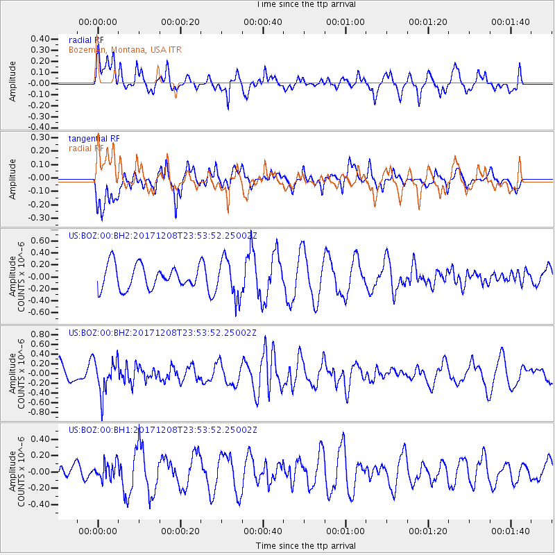
BOZ Bozeman, Montana, USA - Earthquake Result Viewer
*The percent match for this event was below the threshold and hence no stack was calculated.
| Earthquake location: |
Tonga Islands |
| Earthquake latitude/longitude: |
-16.1/-174.0 |
| Earthquake time(UTC): |
2017/12/08 (342) 23:42:09 GMT |
| Earthquake Depth: |
117 km |
| Earthquake Magnitude: |
5.7 mb |
| Earthquake Catalog/Contributor: |
NEIC PDE/us |
|
| Network: |
US United States National Seismic Network |
| Station: |
BOZ Bozeman, Montana, USA |
| Lat/Lon: |
45.65 N/111.63 W |
| Elevation: |
1589 m |
|
| Distance: |
83.3 deg |
| Az: |
38.718 deg |
| Baz: |
238.986 deg |
| Ray Param: |
$rayparam |
*The percent match for this event was below the threshold and hence was not used in the summary stack. |
|
| Radial Match: |
55.41271 % |
| Radial Bump: |
373 |
| Transverse Match: |
52.92228 % |
| Transverse Bump: |
400 |
| SOD ConfigId: |
2429771 |
| Insert Time: |
2017-12-22 23:46:18.749 +0000 |
| GWidth: |
2.5 |
| Max Bumps: |
400 |
| Tol: |
0.001 |
|
Signal To Noise
| Channel | StoN | STA | LTA |
| US:BOZ:00:BHZ:20171208T23:53:52.25002Z | 1.9768758 | 3.4135888E-7 | 1.7267595E-7 |
| US:BOZ:00:BH1:20171208T23:53:52.25002Z | 0.6635414 | 1.0316155E-7 | 1.5547117E-7 |
| US:BOZ:00:BH2:20171208T23:53:52.25002Z | 1.7062433 | 3.287275E-7 | 1.9266157E-7 |
| Arrivals |
| Ps | |
| PpPs | |
| PsPs/PpSs | |


