You are here: Home > Network List > CN - Canadian National Seismograph Network Stations List
> Station INK INUVIK, NT > Earthquake Result Viewer
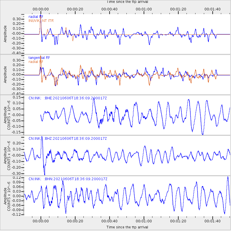
INK INUVIK, NT - Earthquake Result Viewer
*The percent match for this event was below the threshold and hence no stack was calculated.
| Earthquake location: |
Fiji Islands Region |
| Earthquake latitude/longitude: |
-15.9/-177.3 |
| Earthquake time(UTC): |
2021/06/06 (157) 18:24:28 GMT |
| Earthquake Depth: |
422 km |
| Earthquake Magnitude: |
5.6 mww |
| Earthquake Catalog/Contributor: |
NEIC PDE/us |
|
| Network: |
CN Canadian National Seismograph Network |
| Station: |
INK INUVIK, NT |
| Lat/Lon: |
68.31 N/133.53 W |
| Elevation: |
44 m |
|
| Distance: |
89.7 deg |
| Az: |
14.918 deg |
| Baz: |
221.785 deg |
| Ray Param: |
$rayparam |
*The percent match for this event was below the threshold and hence was not used in the summary stack. |
|
| Radial Match: |
59.99816 % |
| Radial Bump: |
399 |
| Transverse Match: |
64.66267 % |
| Transverse Bump: |
392 |
| SOD ConfigId: |
25131211 |
| Insert Time: |
2021-06-20 18:34:06.919 +0000 |
| GWidth: |
2.5 |
| Max Bumps: |
400 |
| Tol: |
0.001 |
|
Signal To Noise
| Channel | StoN | STA | LTA |
| CN:INK: :BHZ:20210606T18:36:09.200017Z | 2.8778389 | 1.5986535E-7 | 5.5550487E-8 |
| CN:INK: :BHN:20210606T18:36:09.200017Z | 1.2295971 | 4.640604E-8 | 3.774085E-8 |
| CN:INK: :BHE:20210606T18:36:09.200017Z | 2.0910716 | 7.740862E-8 | 3.7018637E-8 |
| Arrivals |
| Ps | |
| PpPs | |
| PsPs/PpSs | |


