You are here: Home > Network List > GS - US Geological Survey Networks Stations List
> Station OK051 E0350 and S34600 roads, Ralston OK > Earthquake Result Viewer
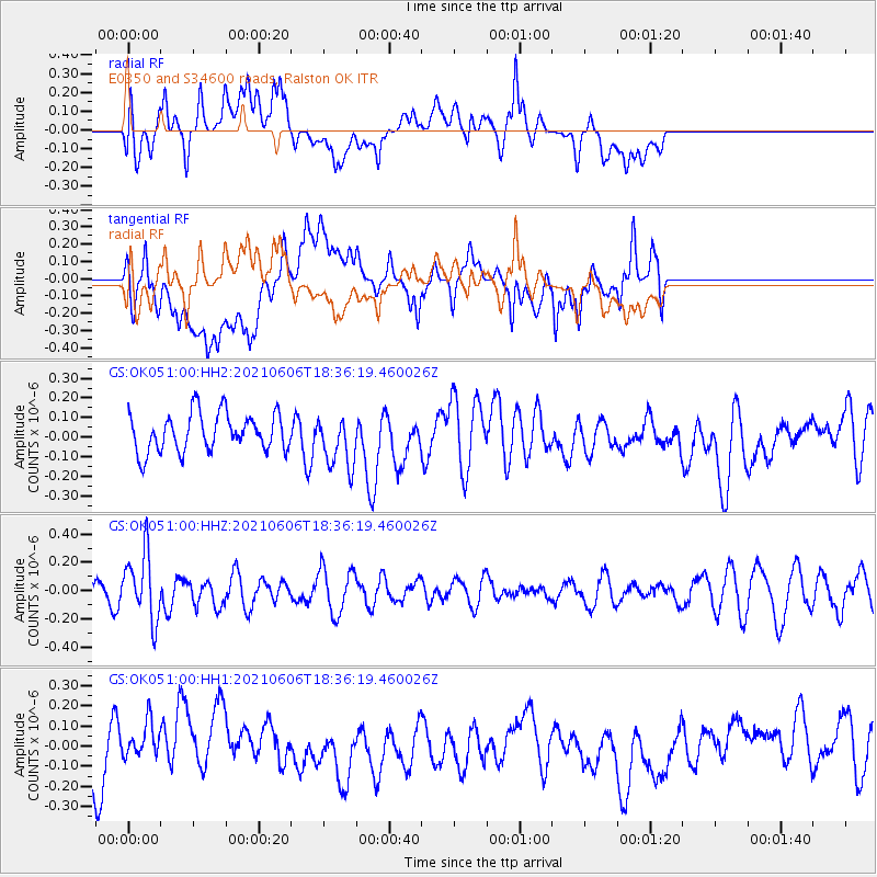
OK051 E0350 and S34600 roads, Ralston OK - Earthquake Result Viewer
*The percent match for this event was below the threshold and hence no stack was calculated.
| Earthquake location: |
Fiji Islands Region |
| Earthquake latitude/longitude: |
-15.9/-177.3 |
| Earthquake time(UTC): |
2021/06/06 (157) 18:24:28 GMT |
| Earthquake Depth: |
422 km |
| Earthquake Magnitude: |
5.6 mww |
| Earthquake Catalog/Contributor: |
NEIC PDE/us |
|
| Network: |
GS US Geological Survey Networks |
| Station: |
OK051 E0350 and S34600 roads, Ralston OK |
| Lat/Lon: |
36.50 N/96.84 W |
| Elevation: |
263 m |
|
| Distance: |
91.9 deg |
| Az: |
52.668 deg |
| Baz: |
251.745 deg |
| Ray Param: |
$rayparam |
*The percent match for this event was below the threshold and hence was not used in the summary stack. |
|
| Radial Match: |
57.20178 % |
| Radial Bump: |
400 |
| Transverse Match: |
66.565605 % |
| Transverse Bump: |
400 |
| SOD ConfigId: |
25131211 |
| Insert Time: |
2021-06-20 18:35:25.966 +0000 |
| GWidth: |
2.5 |
| Max Bumps: |
400 |
| Tol: |
0.001 |
|
Signal To Noise
| Channel | StoN | STA | LTA |
| GS:OK051:00:HHZ:20210606T18:36:19.460026Z | 2.4569435 | 2.3543039E-7 | 9.582247E-8 |
| GS:OK051:00:HH1:20210606T18:36:19.460026Z | 0.6458432 | 9.0944035E-8 | 1.4081442E-7 |
| GS:OK051:00:HH2:20210606T18:36:19.460026Z | 1.3849638 | 1.3511001E-7 | 9.755492E-8 |
| Arrivals |
| Ps | |
| PpPs | |
| PsPs/PpSs | |


