You are here: Home > Network List > US - United States National Seismic Network Stations List
> Station MSO Missoula, Montana, USA > Earthquake Result Viewer
MSO Missoula, Montana, USA - Earthquake Result Viewer
*The percent match for this event was below the threshold and hence no stack was calculated.
| Earthquake location: |
Vanuatu Islands |
| Earthquake latitude/longitude: |
-14.4/167.5 |
| Earthquake time(UTC): |
2017/12/11 (345) 17:29:10 GMT |
| Earthquake Depth: |
187 km |
| Earthquake Magnitude: |
5.6 Mww |
| Earthquake Catalog/Contributor: |
NEIC PDE/us |
|
| Network: |
US United States National Seismic Network |
| Station: |
MSO Missoula, Montana, USA |
| Lat/Lon: |
46.83 N/113.94 W |
| Elevation: |
1264 m |
|
| Distance: |
92.7 deg |
| Az: |
42.365 deg |
| Baz: |
252.02 deg |
| Ray Param: |
$rayparam |
*The percent match for this event was below the threshold and hence was not used in the summary stack. |
|
| Radial Match: |
49.598118 % |
| Radial Bump: |
400 |
| Transverse Match: |
46.100254 % |
| Transverse Bump: |
304 |
| SOD ConfigId: |
2429771 |
| Insert Time: |
2017-12-25 17:31:24.264 +0000 |
| GWidth: |
2.5 |
| Max Bumps: |
400 |
| Tol: |
0.001 |
|
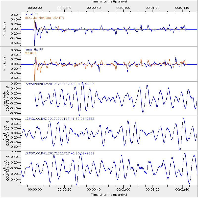
Signal To Noise
| Channel | StoN | STA | LTA |
| US:MSO:00:BHZ:20171211T17:41:30.024988Z | 1.1537098 | 2.0263391E-7 | 1.7563681E-7 |
| US:MSO:00:BH1:20171211T17:41:30.024988Z | 0.5382531 | 1.6451393E-7 | 3.056442E-7 |
| US:MSO:00:BH2:20171211T17:41:30.024988Z | 2.1673856 | 4.436422E-7 | 2.0469002E-7 |
| Arrivals |
| Ps | |
| PpPs | |
| PsPs/PpSs | |


