You are here: Home > Network List > US - United States National Seismic Network Stations List
> Station AMTX Amarillo, Texas, USA > Earthquake Result Viewer
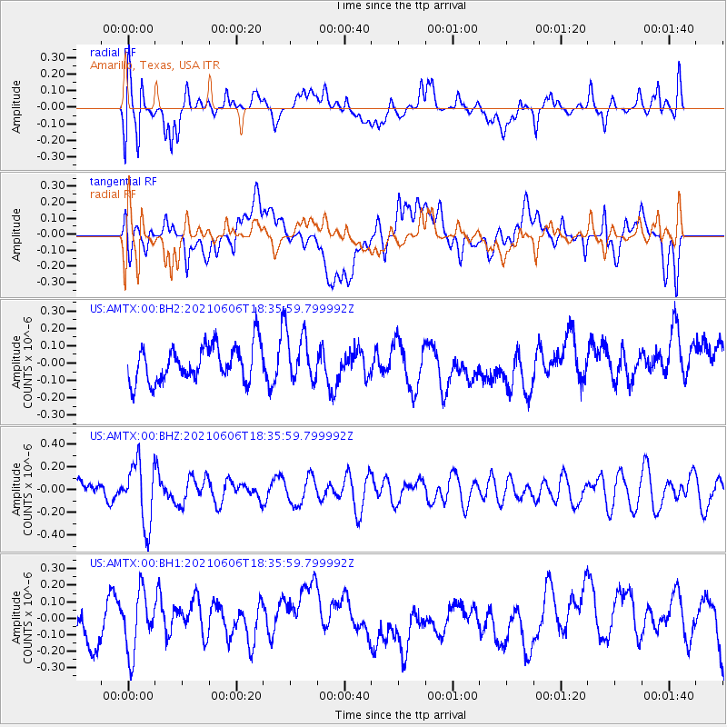
AMTX Amarillo, Texas, USA - Earthquake Result Viewer
*The percent match for this event was below the threshold and hence no stack was calculated.
| Earthquake location: |
Fiji Islands Region |
| Earthquake latitude/longitude: |
-15.9/-177.3 |
| Earthquake time(UTC): |
2021/06/06 (157) 18:24:28 GMT |
| Earthquake Depth: |
422 km |
| Earthquake Magnitude: |
5.6 mww |
| Earthquake Catalog/Contributor: |
NEIC PDE/us |
|
| Network: |
US United States National Seismic Network |
| Station: |
AMTX Amarillo, Texas, USA |
| Lat/Lon: |
34.53 N/101.41 W |
| Elevation: |
1010 m |
|
| Distance: |
87.7 deg |
| Az: |
53.273 deg |
| Baz: |
249.1 deg |
| Ray Param: |
$rayparam |
*The percent match for this event was below the threshold and hence was not used in the summary stack. |
|
| Radial Match: |
46.01401 % |
| Radial Bump: |
400 |
| Transverse Match: |
40.810795 % |
| Transverse Bump: |
400 |
| SOD ConfigId: |
25131211 |
| Insert Time: |
2021-06-20 18:43:58.777 +0000 |
| GWidth: |
2.5 |
| Max Bumps: |
400 |
| Tol: |
0.001 |
|
Signal To Noise
| Channel | StoN | STA | LTA |
| US:AMTX:00:BHZ:20210606T18:35:59.799992Z | 3.158942 | 2.7342742E-7 | 8.6556646E-8 |
| US:AMTX:00:BH1:20210606T18:35:59.799992Z | 1.4623477 | 1.8359268E-7 | 1.2554652E-7 |
| US:AMTX:00:BH2:20210606T18:35:59.799992Z | 1.1402148 | 1.17513515E-7 | 1.0306261E-7 |
| Arrivals |
| Ps | |
| PpPs | |
| PsPs/PpSs | |


