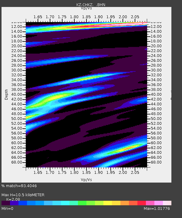
CHKZ Chkalovo, Kazakstan - Earthquake Result Viewer

Earthquake location: Kodiak Island Region, Alaska
Earthquake latitude/longitude: 56.2/-153.5
Earthquake time(UTC): 2000/11/06 (311) 11:40:26 GMT
Earthquake Depth: 20 km
Earthquake Magnitude: 5.5 MB, 5.6 MS, 6.0 MW, 5.5 ML
Earthquake Catalog/Contributor: WHDF/NEIC
Network: KZ Kazakhstan Network
Station: CHKZ Chkalovo, Kazakstan
Lat/Lon: 53.68 N/70.62 E
Elevation: 120 m
Distance: 64.7 deg
Az: 332.767 deg
Baz: 25.495 deg
Ray Param: 0.058716416
Estimated Moho Depth: 10.5 km
Estimated Crust Vp/Vs: 2.08
Assumed Crust Vp: 6.552 km/s
Estimated Crust Vs: 3.15 km/s
Estimated Crust Poisson's Ratio: 0.35
Radial Match: 93.4046 %
Radial Bump: 327
Transverse Match: 80.1595 %
Transverse Bump: 400
SOD ConfigId: 3744
Insert Time: 2010-03-09 09:01:43.432 +0000
GWidth: 2.5
Max Bumps: 400
Tol: 0.001

Signal To Noise

ChannelStoNSTALTA
KZ:CHKZ: :BHN:20001106T11:50:32.480015Z10.0197414.1472916E-74.1391207E-8
KZ:CHKZ: :BHE:20001106T11:50:32.480015Z4.85373072.2299587E-74.5943185E-8
KZ:CHKZ: :BHZ:20001106T11:50:32.480015Z11.7709599.014072E-77.657891E-8
Arrivals
Ps1.8 SECOND
PpPs4.8 SECOND
PsPs/PpSs6.6 SECOND