You are here: Home > Network List > UW - Pacific Northwest Regional Seismic Network Stations List
> Station UMAT Pilot Rock, OR, USA > Earthquake Result Viewer
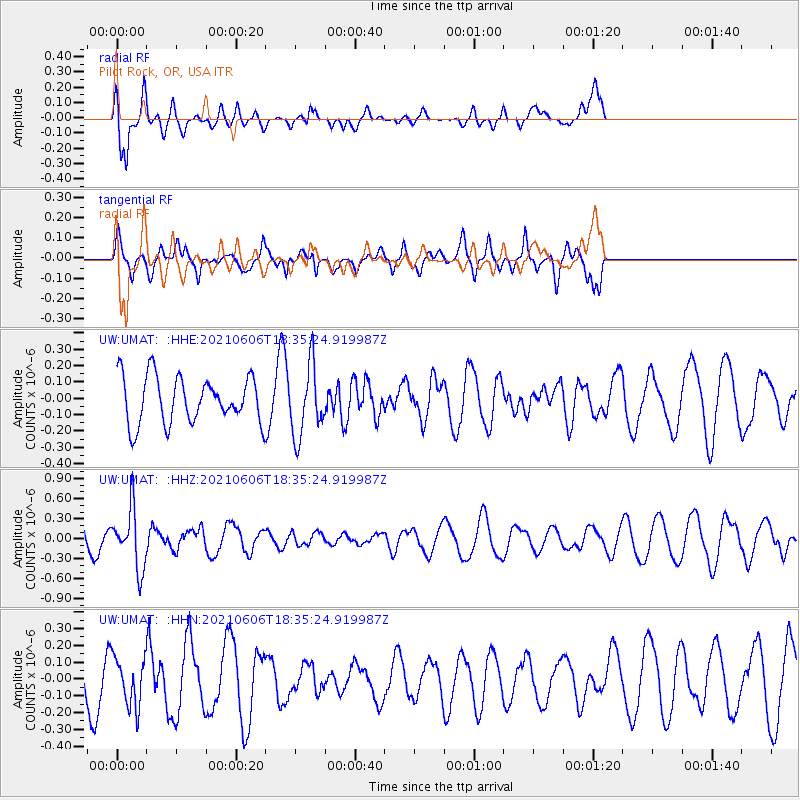
UMAT Pilot Rock, OR, USA - Earthquake Result Viewer
*The percent match for this event was below the threshold and hence no stack was calculated.
| Earthquake location: |
Fiji Islands Region |
| Earthquake latitude/longitude: |
-15.9/-177.3 |
| Earthquake time(UTC): |
2021/06/06 (157) 18:24:28 GMT |
| Earthquake Depth: |
422 km |
| Earthquake Magnitude: |
5.6 mww |
| Earthquake Catalog/Contributor: |
NEIC PDE/us |
|
| Network: |
UW Pacific Northwest Regional Seismic Network |
| Station: |
UMAT Pilot Rock, OR, USA |
| Lat/Lon: |
45.29 N/118.96 W |
| Elevation: |
1318 m |
|
| Distance: |
80.6 deg |
| Az: |
37.542 deg |
| Baz: |
236.169 deg |
| Ray Param: |
$rayparam |
*The percent match for this event was below the threshold and hence was not used in the summary stack. |
|
| Radial Match: |
83.78311 % |
| Radial Bump: |
340 |
| Transverse Match: |
33.97881 % |
| Transverse Bump: |
272 |
| SOD ConfigId: |
25131211 |
| Insert Time: |
2021-06-20 18:46:10.613 +0000 |
| GWidth: |
2.5 |
| Max Bumps: |
400 |
| Tol: |
0.001 |
|
Signal To Noise
| Channel | StoN | STA | LTA |
| UW:UMAT: :HHZ:20210606T18:35:24.919987Z | 1.921027 | 4.4217157E-7 | 2.3017456E-7 |
| UW:UMAT: :HHN:20210606T18:35:24.919987Z | 1.9692659 | 1.4613296E-7 | 7.420682E-8 |
| UW:UMAT: :HHE:20210606T18:35:24.919987Z | 1.5309973 | 2.166405E-7 | 1.4150287E-7 |
| Arrivals |
| Ps | |
| PpPs | |
| PsPs/PpSs | |


