You are here: Home > Network List > WY - Yellowstone Wyoming Seismic Network Stations List
> Station YHH Holmes Hill, YNP, WY, USA > Earthquake Result Viewer
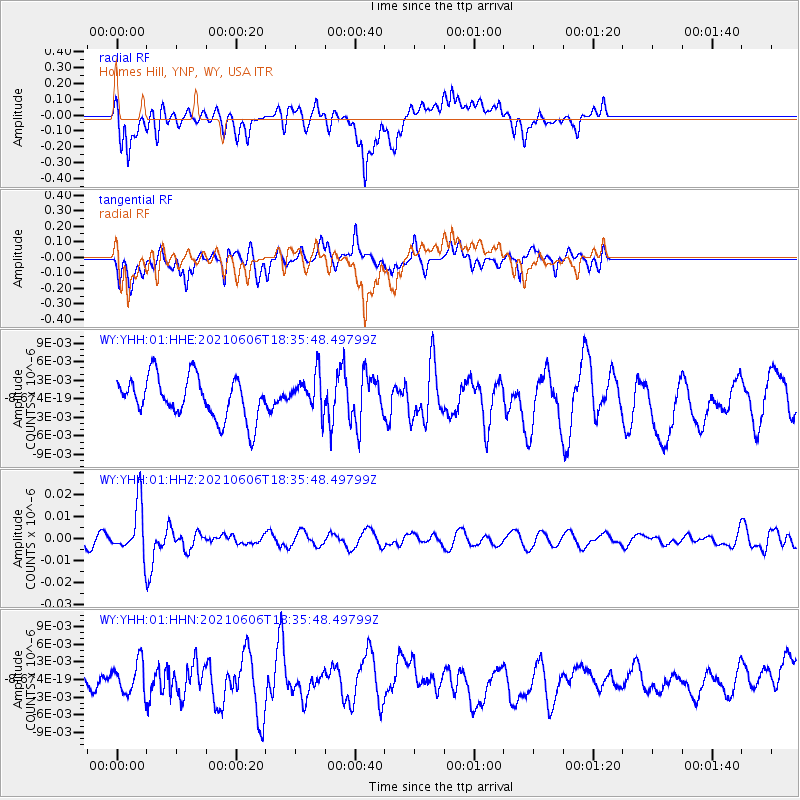
YHH Holmes Hill, YNP, WY, USA - Earthquake Result Viewer
*The percent match for this event was below the threshold and hence no stack was calculated.
| Earthquake location: |
Fiji Islands Region |
| Earthquake latitude/longitude: |
-15.9/-177.3 |
| Earthquake time(UTC): |
2021/06/06 (157) 18:24:28 GMT |
| Earthquake Depth: |
422 km |
| Earthquake Magnitude: |
5.6 mww |
| Earthquake Catalog/Contributor: |
NEIC PDE/us |
|
| Network: |
WY Yellowstone Wyoming Seismic Network |
| Station: |
YHH Holmes Hill, YNP, WY, USA |
| Lat/Lon: |
44.79 N/110.85 W |
| Elevation: |
2717 m |
|
| Distance: |
85.3 deg |
| Az: |
40.937 deg |
| Baz: |
242.311 deg |
| Ray Param: |
$rayparam |
*The percent match for this event was below the threshold and hence was not used in the summary stack. |
|
| Radial Match: |
52.040447 % |
| Radial Bump: |
400 |
| Transverse Match: |
57.77212 % |
| Transverse Bump: |
400 |
| SOD ConfigId: |
25131211 |
| Insert Time: |
2021-06-20 18:46:20.223 +0000 |
| GWidth: |
2.5 |
| Max Bumps: |
400 |
| Tol: |
0.001 |
|
Signal To Noise
| Channel | StoN | STA | LTA |
| WY:YHH:01:HHZ:20210606T18:35:48.49799Z | 2.9122586 | 1.12441345E-8 | 3.860967E-9 |
| WY:YHH:01:HHN:20210606T18:35:48.49799Z | 1.0621763 | 2.6742724E-9 | 2.5177294E-9 |
| WY:YHH:01:HHE:20210606T18:35:48.49799Z | 0.8995577 | 2.9961134E-9 | 3.3306518E-9 |
| Arrivals |
| Ps | |
| PpPs | |
| PsPs/PpSs | |


