You are here: Home > Network List > AV - Alaska Volcano Observatory Stations List
> Station SPCR Ckakachatna River, Mount Spurr, Alaska > Earthquake Result Viewer
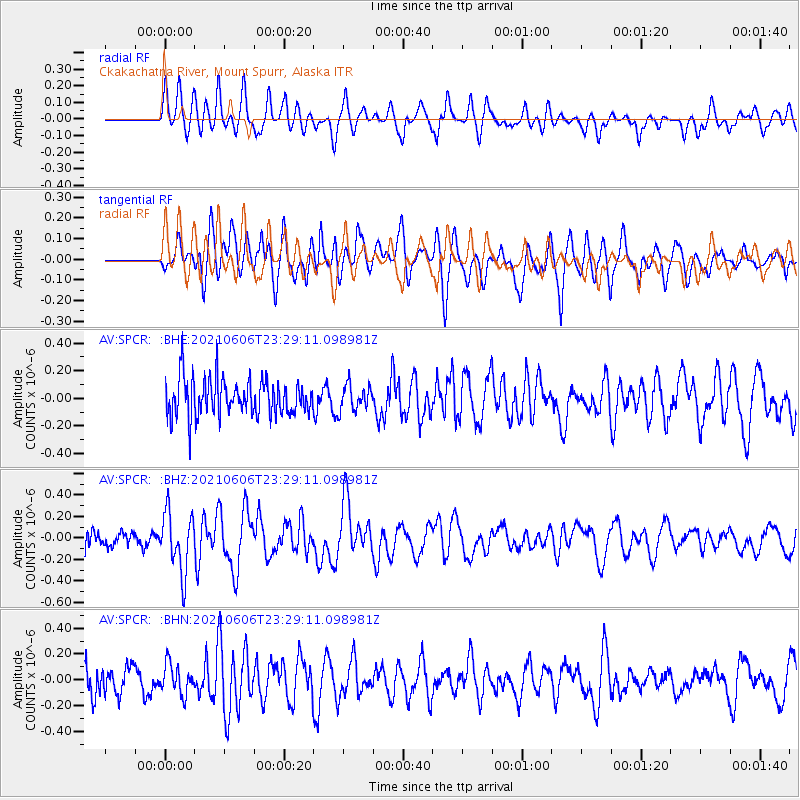
SPCR Ckakachatna River, Mount Spurr, Alaska - Earthquake Result Viewer
*The percent match for this event was below the threshold and hence no stack was calculated.
| Earthquake location: |
Kermadec Islands Region |
| Earthquake latitude/longitude: |
-27.7/-176.3 |
| Earthquake time(UTC): |
2021/06/06 (157) 23:16:39 GMT |
| Earthquake Depth: |
10 km |
| Earthquake Magnitude: |
5.8 mww |
| Earthquake Catalog/Contributor: |
NEIC PDE/us |
|
| Network: |
AV Alaska Volcano Observatory |
| Station: |
SPCR Ckakachatna River, Mount Spurr, Alaska |
| Lat/Lon: |
61.20 N/152.21 W |
| Elevation: |
984 m |
|
| Distance: |
90.7 deg |
| Az: |
11.401 deg |
| Baz: |
201.225 deg |
| Ray Param: |
$rayparam |
*The percent match for this event was below the threshold and hence was not used in the summary stack. |
|
| Radial Match: |
52.700188 % |
| Radial Bump: |
400 |
| Transverse Match: |
63.48258 % |
| Transverse Bump: |
400 |
| SOD ConfigId: |
25131211 |
| Insert Time: |
2021-06-20 23:21:32.247 +0000 |
| GWidth: |
2.5 |
| Max Bumps: |
400 |
| Tol: |
0.001 |
|
Signal To Noise
| Channel | StoN | STA | LTA |
| AV:SPCR: :BHZ:20210606T23:29:11.098981Z | 2.7257361 | 2.7569394E-7 | 1.0114476E-7 |
| AV:SPCR: :BHN:20210606T23:29:11.098981Z | 0.746662 | 1.1638275E-7 | 1.5587074E-7 |
| AV:SPCR: :BHE:20210606T23:29:11.098981Z | 0.6679166 | 9.017108E-8 | 1.350035E-7 |
| Arrivals |
| Ps | |
| PpPs | |
| PsPs/PpSs | |


