You are here: Home > Network List > UW - Pacific Northwest Regional Seismic Network Stations List
> Station UMAT Pilot Rock, OR, USA > Earthquake Result Viewer
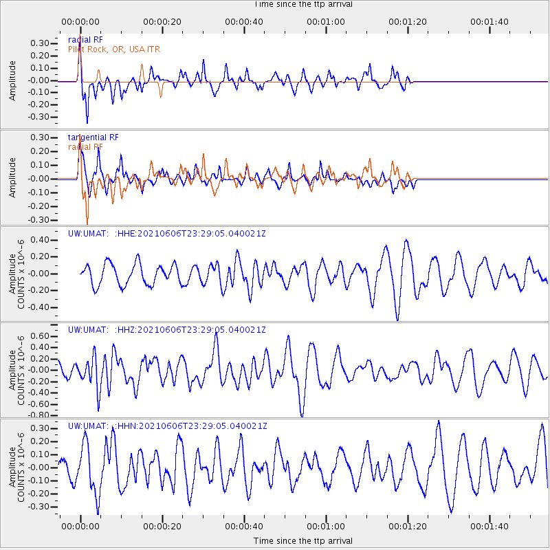
UMAT Pilot Rock, OR, USA - Earthquake Result Viewer
*The percent match for this event was below the threshold and hence no stack was calculated.
| Earthquake location: |
Kermadec Islands Region |
| Earthquake latitude/longitude: |
-27.7/-176.3 |
| Earthquake time(UTC): |
2021/06/06 (157) 23:16:39 GMT |
| Earthquake Depth: |
10 km |
| Earthquake Magnitude: |
5.8 mww |
| Earthquake Catalog/Contributor: |
NEIC PDE/us |
|
| Network: |
UW Pacific Northwest Regional Seismic Network |
| Station: |
UMAT Pilot Rock, OR, USA |
| Lat/Lon: |
45.29 N/118.96 W |
| Elevation: |
1318 m |
|
| Distance: |
89.4 deg |
| Az: |
36.464 deg |
| Baz: |
228.305 deg |
| Ray Param: |
$rayparam |
*The percent match for this event was below the threshold and hence was not used in the summary stack. |
|
| Radial Match: |
74.336586 % |
| Radial Bump: |
390 |
| Transverse Match: |
59.45825 % |
| Transverse Bump: |
400 |
| SOD ConfigId: |
25131211 |
| Insert Time: |
2021-06-20 23:34:20.949 +0000 |
| GWidth: |
2.5 |
| Max Bumps: |
400 |
| Tol: |
0.001 |
|
Signal To Noise
| Channel | StoN | STA | LTA |
| UW:UMAT: :HHZ:20210606T23:29:05.040021Z | 3.1217039 | 2.7209455E-7 | 8.716219E-8 |
| UW:UMAT: :HHN:20210606T23:29:05.040021Z | 1.8525552 | 1.9049764E-7 | 1.02829674E-7 |
| UW:UMAT: :HHE:20210606T23:29:05.040021Z | 0.9469958 | 1.12935474E-7 | 1.1925657E-7 |
| Arrivals |
| Ps | |
| PpPs | |
| PsPs/PpSs | |


