
NRN XW.NRN - Earthquake Result Viewer
| ||||||||||||||||||
| ||||||||||||||||||
| ||||||||||||||||||
|
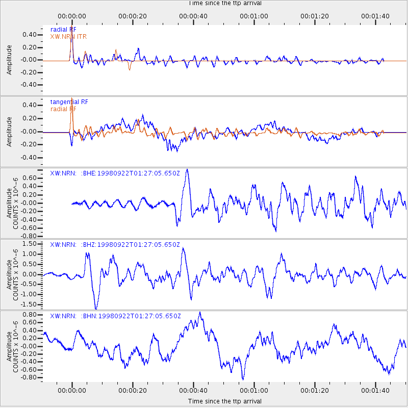
Signal To Noise
| Channel | StoN | STA | LTA |
| XW:NRN: :BHZ:19980922T01:27:05.650Z | 5.214261 | 3.432501E-7 | 6.58291E-8 |
| XW:NRN: :BHN:19980922T01:27:05.650Z | 1.1340998 | 2.3347363E-7 | 2.058669E-7 |
| XW:NRN: :BHE:19980922T01:27:05.650Z | 2.4572022 | 1.6148782E-7 | 6.57202E-8 |
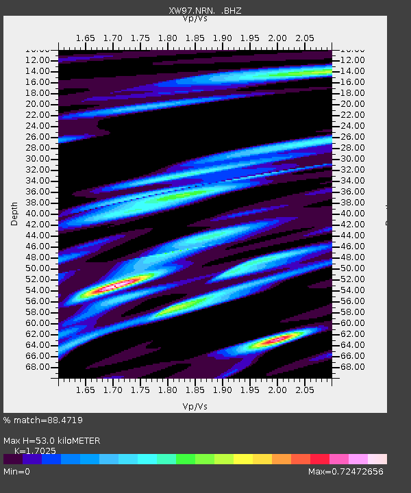
| Arrivals | |
| Ps | 6.0 SECOND |
| PpPs | 21 SECOND |
| PsPs/PpSs | 27 SECOND |

