You are here: Home > Network List > UW - Pacific Northwest Regional Seismic Network Stations List
> Station UMAT Pilot Rock, OR, USA > Earthquake Result Viewer
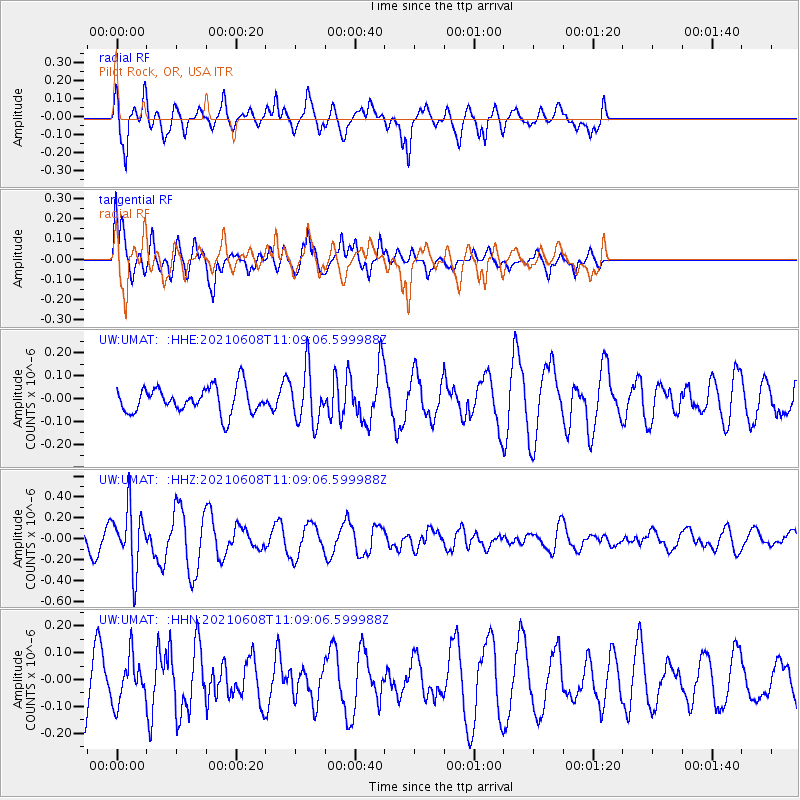
UMAT Pilot Rock, OR, USA - Earthquake Result Viewer
*The percent match for this event was below the threshold and hence no stack was calculated.
| Earthquake location: |
New Britain Region, P.N.G. |
| Earthquake latitude/longitude: |
-5.2/151.3 |
| Earthquake time(UTC): |
2021/06/08 (159) 10:56:38 GMT |
| Earthquake Depth: |
139 km |
| Earthquake Magnitude: |
5.7 Mww |
| Earthquake Catalog/Contributor: |
NEIC PDE/us |
|
| Network: |
UW Pacific Northwest Regional Seismic Network |
| Station: |
UMAT Pilot Rock, OR, USA |
| Lat/Lon: |
45.29 N/118.96 W |
| Elevation: |
1318 m |
|
| Distance: |
93.5 deg |
| Az: |
45.006 deg |
| Baz: |
266.191 deg |
| Ray Param: |
$rayparam |
*The percent match for this event was below the threshold and hence was not used in the summary stack. |
|
| Radial Match: |
85.96809 % |
| Radial Bump: |
373 |
| Transverse Match: |
65.53313 % |
| Transverse Bump: |
380 |
| SOD ConfigId: |
25131211 |
| Insert Time: |
2021-06-22 11:13:50.706 +0000 |
| GWidth: |
2.5 |
| Max Bumps: |
400 |
| Tol: |
0.001 |
|
Signal To Noise
| Channel | StoN | STA | LTA |
| UW:UMAT: :HHZ:20210608T11:09:06.599988Z | 3.3916895 | 2.8692867E-7 | 8.459756E-8 |
| UW:UMAT: :HHN:20210608T11:09:06.599988Z | 1.0135586 | 8.330439E-8 | 8.219001E-8 |
| UW:UMAT: :HHE:20210608T11:09:06.599988Z | 2.0346425 | 1.16429966E-7 | 5.7223794E-8 |
| Arrivals |
| Ps | |
| PpPs | |
| PsPs/PpSs | |


