You are here: Home > Network List > II - Global Seismograph Network (GSN - IRIS/IDA) Stations List
> Station ABPO Ambohimpanompo, Madagascar > Earthquake Result Viewer
ABPO Ambohimpanompo, Madagascar - Earthquake Result Viewer

| Earthquake location: |
Northern And Central Iran |
| Earthquake latitude/longitude: |
30.8/57.3 |
| Earthquake time(UTC): |
2017/12/12 (346) 21:41:31 GMT |
| Earthquake Depth: |
8.0 km |
| Earthquake Magnitude: |
6.0 Mww |
| Earthquake Catalog/Contributor: |
NEIC PDE/us |
|
| Network: |
II Global Seismograph Network (GSN - IRIS/IDA) |
| Station: |
ABPO Ambohimpanompo, Madagascar |
| Lat/Lon: |
19.02 S/47.23 E |
| Elevation: |
1528 m |
|
| Distance: |
50.5 deg |
| Az: |
192.366 deg |
| Baz: |
11.229 deg |
| Ray Param: |
0.06802897 |
| Estimated Moho Depth: |
18.5 km |
| Estimated Crust Vp/Vs: |
1.60 |
| Assumed Crust Vp: |
6.642 km/s |
| Estimated Crust Vs: |
4.151 km/s |
| Estimated Crust Poisson's Ratio: |
0.18 |
|
| Radial Match: |
80.99398 % |
| Radial Bump: |
374 |
| Transverse Match: |
52.281586 % |
| Transverse Bump: |
392 |
| SOD ConfigId: |
2429771 |
| Insert Time: |
2017-12-26 21:42:25.894 +0000 |
| GWidth: |
2.5 |
| Max Bumps: |
400 |
| Tol: |
0.001 |
|
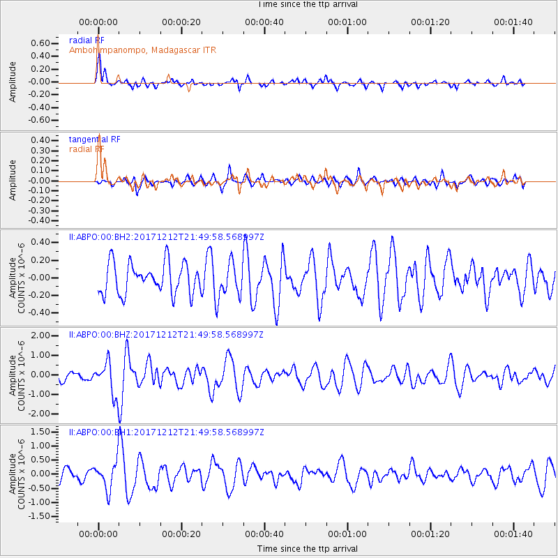
Signal To Noise
| Channel | StoN | STA | LTA |
| II:ABPO:00:BHZ:20171212T21:49:58.568997Z | 1.951881 | 8.9987645E-7 | 4.6103037E-7 |
| II:ABPO:00:BH1:20171212T21:49:58.568997Z | 2.1582625 | 5.3122596E-7 | 2.4613593E-7 |
| II:ABPO:00:BH2:20171212T21:49:58.568997Z | 0.9961127 | 1.7270412E-7 | 1.733781E-7 |
| Arrivals |
| Ps | 1.8 SECOND |
| PpPs | 6.8 SECOND |
| PsPs/PpSs | 8.6 SECOND |


