You are here: Home > Network List > CN - Canadian National Seismograph Network Stations List
> Station INK INUVIK, NT > Earthquake Result Viewer
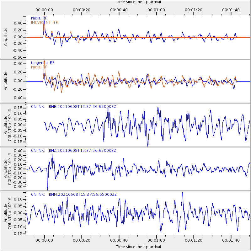
INK INUVIK, NT - Earthquake Result Viewer
*The percent match for this event was below the threshold and hence no stack was calculated.
| Earthquake location: |
Off East Coast Of Honshu, Japan |
| Earthquake latitude/longitude: |
36.4/143.1 |
| Earthquake time(UTC): |
2021/06/08 (159) 15:29:01 GMT |
| Earthquake Depth: |
10 km |
| Earthquake Magnitude: |
5.3 Mww |
| Earthquake Catalog/Contributor: |
NEIC PDE/us |
|
| Network: |
CN Canadian National Seismograph Network |
| Station: |
INK INUVIK, NT |
| Lat/Lon: |
68.31 N/133.53 W |
| Elevation: |
44 m |
|
| Distance: |
54.3 deg |
| Az: |
27.038 deg |
| Baz: |
279.48 deg |
| Ray Param: |
$rayparam |
*The percent match for this event was below the threshold and hence was not used in the summary stack. |
|
| Radial Match: |
70.32717 % |
| Radial Bump: |
400 |
| Transverse Match: |
53.90765 % |
| Transverse Bump: |
400 |
| SOD ConfigId: |
25131211 |
| Insert Time: |
2021-06-22 15:37:51.260 +0000 |
| GWidth: |
2.5 |
| Max Bumps: |
400 |
| Tol: |
0.001 |
|
Signal To Noise
| Channel | StoN | STA | LTA |
| CN:INK: :BHZ:20210608T15:37:56.650003Z | 2.9174764 | 1.6210373E-7 | 5.5563E-8 |
| CN:INK: :BHN:20210608T15:37:56.650003Z | 0.68974036 | 3.61415E-8 | 5.23987E-8 |
| CN:INK: :BHE:20210608T15:37:56.650003Z | 1.7881086 | 6.3982085E-8 | 3.578199E-8 |
| Arrivals |
| Ps | |
| PpPs | |
| PsPs/PpSs | |


