
NRN XW.NRN - Earthquake Result Viewer
| ||||||||||||||||||
| ||||||||||||||||||
| ||||||||||||||||||
|
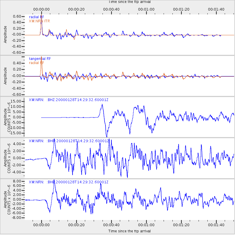
Signal To Noise
| Channel | StoN | STA | LTA |
| XW:NRN: :BHN:20000128T14:29:32.60001Z | 4.1097927 | 1.0987095E-6 | 2.6733937E-7 |
| XW:NRN: :BHE:20000128T14:29:32.60001Z | 27.749716 | 2.0966804E-6 | 7.555682E-8 |
| XW:NRN: :BHZ:20000128T14:29:32.60001Z | 46.69052 | 4.757625E-6 | 1.0189702E-7 |
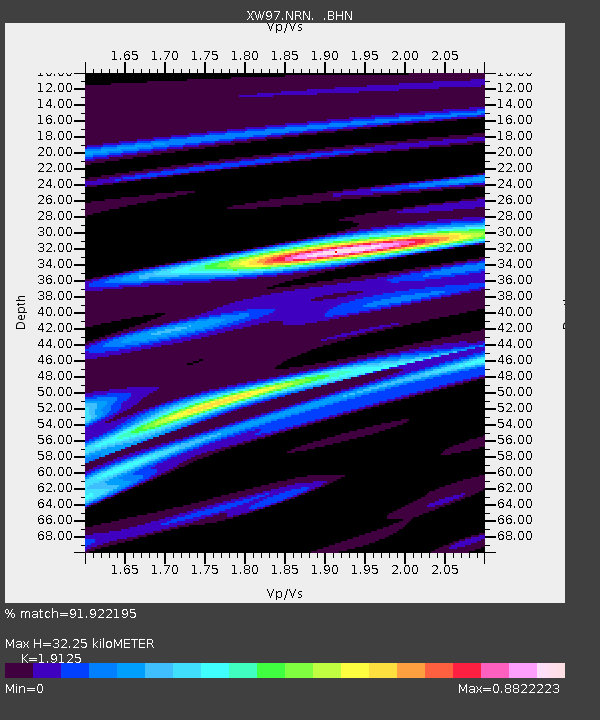
| Arrivals | |
| Ps | 4.8 SECOND |
| PpPs | 14 SECOND |
| PsPs/PpSs | 18 SECOND |

