You are here: Home > Network List > AV - Alaska Volcano Observatory Stations List
> Station MAPS Pakushin Southeast, Makushin Volcano, Alaska > Earthquake Result Viewer
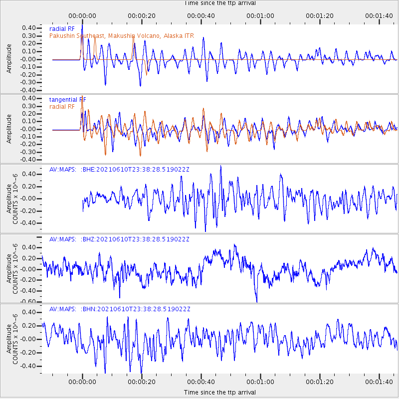
MAPS Pakushin Southeast, Makushin Volcano, Alaska - Earthquake Result Viewer
*The percent match for this event was below the threshold and hence no stack was calculated.
| Earthquake location: |
Off Coast Of Costa Rica |
| Earthquake latitude/longitude: |
9.0/-85.4 |
| Earthquake time(UTC): |
2021/06/10 (161) 23:27:02 GMT |
| Earthquake Depth: |
10 km |
| Earthquake Magnitude: |
5.7 Mww |
| Earthquake Catalog/Contributor: |
NEIC PDE/us |
|
| Network: |
AV Alaska Volcano Observatory |
| Station: |
MAPS Pakushin Southeast, Makushin Volcano, Alaska |
| Lat/Lon: |
53.81 N/166.94 W |
| Elevation: |
333 m |
|
| Distance: |
77.8 deg |
| Az: |
323.123 deg |
| Baz: |
91.496 deg |
| Ray Param: |
$rayparam |
*The percent match for this event was below the threshold and hence was not used in the summary stack. |
|
| Radial Match: |
56.275604 % |
| Radial Bump: |
400 |
| Transverse Match: |
60.479572 % |
| Transverse Bump: |
400 |
| SOD ConfigId: |
25131211 |
| Insert Time: |
2021-06-24 23:31:27.223 +0000 |
| GWidth: |
2.5 |
| Max Bumps: |
400 |
| Tol: |
0.001 |
|
Signal To Noise
| Channel | StoN | STA | LTA |
| AV:MAPS: :BHZ:20210610T23:38:28.519022Z | 0.8300538 | 1.252441E-7 | 1.5088672E-7 |
| AV:MAPS: :BHN:20210610T23:38:28.519022Z | 1.1862193 | 1.7686166E-7 | 1.4909693E-7 |
| AV:MAPS: :BHE:20210610T23:38:28.519022Z | 1.5813481 | 1.6863959E-7 | 1.0664293E-7 |
| Arrivals |
| Ps | |
| PpPs | |
| PsPs/PpSs | |


