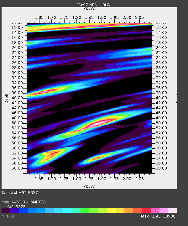
NRN XW.NRN - Earthquake Result Viewer
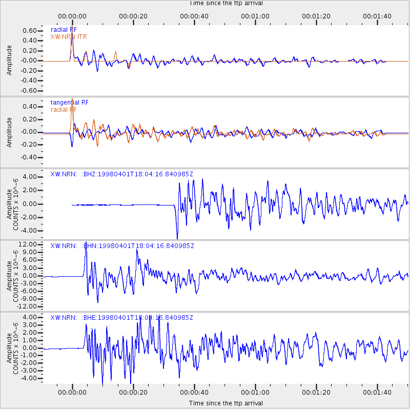
Earthquake location: Southern Sumatra, Indonesia
Earthquake latitude/longitude: -0.5/99.3
Earthquake time(UTC): 1998/04/01 (091) 17:56:23 GMT
Earthquake Depth: 56 km
Earthquake Magnitude: 6.2 MB, 6.9 MS, 7.0 UNKNOWN, 6.6 ME
Earthquake Catalog/Contributor: WHDF/NEIC
Network: XW Tien Shan Continental Dynamics
Station: NRN XW.NRN
Lat/Lon: 41.42 N/75.98 E
Elevation: 2019 m
Distance: 46.8 deg
Az: 335.935 deg
Baz: 147.167 deg
Ray Param: 0.070254415
Estimated Moho Depth: 52.0 km
Estimated Crust Vp/Vs: 1.83
Assumed Crust Vp: 6.491 km/s
Estimated Crust Vs: 3.542 km/s
Estimated Crust Poisson's Ratio: 0.29
Radial Match: 92.8637 %
Radial Bump: 400
Transverse Match: 85.04286 %
Transverse Bump: 400
SOD ConfigId: 4480
Insert Time: 2010-02-26 15:39:41.640 +0000
GWidth: 2.5
Max Bumps: 400
Tol: 0.001

Signal To Noise

ChannelStoNSTALTA
XW:NRN: :BHN:19980401T18:04:16.840985Z102.981623.724245E-63.6164174E-8
XW:NRN: :BHE:19980401T18:04:16.840985Z22.5321459.223427E-74.093453E-8
XW:NRN: :BHZ:19980401T18:04:16.840985Z78.966331.4257424E-61.8055067E-8
Arrivals
Ps7.1 SECOND
PpPs21 SECOND
PsPs/PpSs28 SECOND