NRN XW.NRN - Earthquake Result Viewer
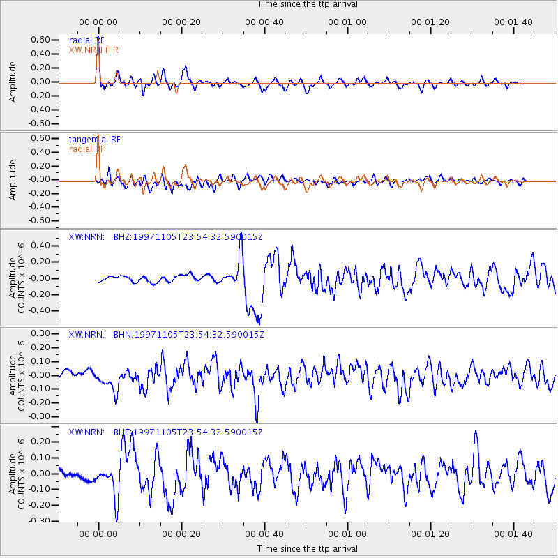
Earthquake location: Bonin Islands, Japan Region
Earthquake latitude/longitude: 27.9/142.6
Earthquake time(UTC): 1997/11/05 (309) 23:45:30 GMT
Earthquake Depth: 10 km
Earthquake Magnitude: 5.4 MB, 5.6 MS, 6.0 UNKNOWN, 5.9 MW
Earthquake Catalog/Contributor: WHDF/NEIC
Network: XW Tien Shan Continental Dynamics
Station: NRN XW.NRN
Lat/Lon: 41.42 N/75.98 E
Elevation: 2019 m
Distance: 55.2 deg
Az: 302.797 deg
Baz: 81.728 deg
Ray Param: 0.06494321
Estimated Moho Depth: 31.0 km
Estimated Crust Vp/Vs: 1.96
Assumed Crust Vp: 6.491 km/s
Estimated Crust Vs: 3.312 km/s
Estimated Crust Poisson's Ratio: 0.32
Radial Match: 82.89304 %
Radial Bump: 400
Transverse Match: 73.30618 %
Transverse Bump: 400
SOD ConfigId: 6273
Insert Time: 2010-02-26 15:39:48.659 +0000
GWidth: 2.5
Max Bumps: 400
Tol: 0.001

Signal To Noise

ChannelStoNSTALTA
XW:NRN: :BHN:19971105T23:54:32.590015Z2.268358.239393E-83.632329E-8
XW:NRN: :BHE:19971105T23:54:32.590015Z3.24615291.0958261E-73.3757686E-8
XW:NRN: :BHZ:19971105T23:54:32.590015Z5.2641511.9946408E-73.7891024E-8
Arrivals
Ps4.8 SECOND
PpPs13 SECOND
PsPs/PpSs18 SECOND