
NRN XW.NRN - Earthquake Result Viewer
| ||||||||||||||||||
| ||||||||||||||||||
| ||||||||||||||||||
|
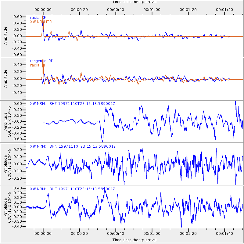
Signal To Noise
| Channel | StoN | STA | LTA |
| XW:NRN: :BHN:19971110T23:15:13.589001Z | 1.7196945 | 5.8659218E-8 | 3.4110254E-8 |
| XW:NRN: :BHE:19971110T23:15:13.589001Z | 6.2059307 | 1.4170394E-7 | 2.2833632E-8 |
| XW:NRN: :BHZ:19971110T23:15:13.589001Z | 7.023995 | 3.2666472E-7 | 4.650697E-8 |
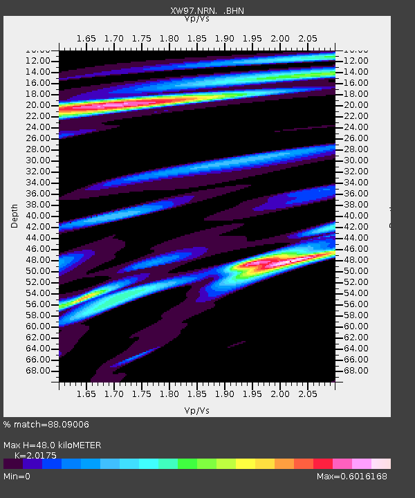
| Arrivals | |
| Ps | 7.9 SECOND |
| PpPs | 21 SECOND |
| PsPs/PpSs | 29 SECOND |

