You are here: Home > Network List > AV - Alaska Volcano Observatory Stations List
> Station AMKA Regional Station, Amchitka Island, Alaska > Earthquake Result Viewer
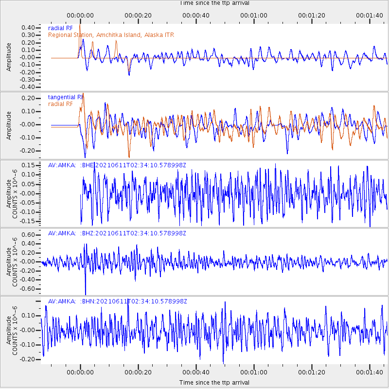
AMKA Regional Station, Amchitka Island, Alaska - Earthquake Result Viewer
*The percent match for this event was below the threshold and hence no stack was calculated.
| Earthquake location: |
Minahassa Peninsula, Sulawesi |
| Earthquake latitude/longitude: |
0.0/124.3 |
| Earthquake time(UTC): |
2021/06/11 (162) 02:23:43 GMT |
| Earthquake Depth: |
64 km |
| Earthquake Magnitude: |
5.5 Mww |
| Earthquake Catalog/Contributor: |
NEIC PDE/us |
|
| Network: |
AV Alaska Volcano Observatory |
| Station: |
AMKA Regional Station, Amchitka Island, Alaska |
| Lat/Lon: |
51.38 N/179.30 E |
| Elevation: |
116 m |
|
| Distance: |
68.9 deg |
| Az: |
33.392 deg |
| Baz: |
241.421 deg |
| Ray Param: |
$rayparam |
*The percent match for this event was below the threshold and hence was not used in the summary stack. |
|
| Radial Match: |
45.782024 % |
| Radial Bump: |
400 |
| Transverse Match: |
58.49457 % |
| Transverse Bump: |
400 |
| SOD ConfigId: |
25131211 |
| Insert Time: |
2021-06-25 02:27:31.186 +0000 |
| GWidth: |
2.5 |
| Max Bumps: |
400 |
| Tol: |
0.001 |
|
Signal To Noise
| Channel | StoN | STA | LTA |
| AV:AMKA: :BHZ:20210611T02:34:10.578998Z | 3.0314689 | 2.0952345E-7 | 6.911615E-8 |
| AV:AMKA: :BHN:20210611T02:34:10.578998Z | 0.87343174 | 5.2919923E-8 | 6.0588505E-8 |
| AV:AMKA: :BHE:20210611T02:34:10.578998Z | 0.86998314 | 5.8823144E-8 | 6.7614124E-8 |
| Arrivals |
| Ps | |
| PpPs | |
| PsPs/PpSs | |


