You are here: Home > Network List > AV - Alaska Volcano Observatory Stations List
> Station SPCR Ckakachatna River, Mount Spurr, Alaska > Earthquake Result Viewer
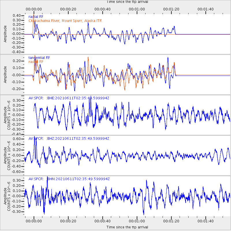
SPCR Ckakachatna River, Mount Spurr, Alaska - Earthquake Result Viewer
*The percent match for this event was below the threshold and hence no stack was calculated.
| Earthquake location: |
Minahassa Peninsula, Sulawesi |
| Earthquake latitude/longitude: |
0.0/124.3 |
| Earthquake time(UTC): |
2021/06/11 (162) 02:23:43 GMT |
| Earthquake Depth: |
64 km |
| Earthquake Magnitude: |
5.5 Mww |
| Earthquake Catalog/Contributor: |
NEIC PDE/us |
|
| Network: |
AV Alaska Volcano Observatory |
| Station: |
SPCR Ckakachatna River, Mount Spurr, Alaska |
| Lat/Lon: |
61.20 N/152.21 W |
| Elevation: |
984 m |
|
| Distance: |
86.8 deg |
| Az: |
28.807 deg |
| Baz: |
264.331 deg |
| Ray Param: |
$rayparam |
*The percent match for this event was below the threshold and hence was not used in the summary stack. |
|
| Radial Match: |
54.19371 % |
| Radial Bump: |
400 |
| Transverse Match: |
60.705997 % |
| Transverse Bump: |
400 |
| SOD ConfigId: |
25131211 |
| Insert Time: |
2021-06-25 02:28:51.938 +0000 |
| GWidth: |
2.5 |
| Max Bumps: |
400 |
| Tol: |
0.001 |
|
Signal To Noise
| Channel | StoN | STA | LTA |
| AV:SPCR: :BHZ:20210611T02:35:49.599994Z | 2.5663116 | 3.0356804E-7 | 1.1828963E-7 |
| AV:SPCR: :BHN:20210611T02:35:49.599994Z | 1.82689 | 1.15891865E-7 | 6.3436694E-8 |
| AV:SPCR: :BHE:20210611T02:35:49.599994Z | 1.1367824 | 1.5551285E-7 | 1.368009E-7 |
| Arrivals |
| Ps | |
| PpPs | |
| PsPs/PpSs | |


