You are here: Home > Network List > CN - Canadian National Seismograph Network Stations List
> Station INK INUVIK, NT > Earthquake Result Viewer
INK INUVIK, NT - Earthquake Result Viewer
*The percent match for this event was below the threshold and hence no stack was calculated.
| Earthquake location: |
Minahassa Peninsula, Sulawesi |
| Earthquake latitude/longitude: |
0.0/124.3 |
| Earthquake time(UTC): |
2021/06/11 (162) 02:23:43 GMT |
| Earthquake Depth: |
64 km |
| Earthquake Magnitude: |
5.5 Mww |
| Earthquake Catalog/Contributor: |
NEIC PDE/us |
|
| Network: |
CN Canadian National Seismograph Network |
| Station: |
INK INUVIK, NT |
| Lat/Lon: |
68.31 N/133.53 W |
| Elevation: |
44 m |
|
| Distance: |
94.5 deg |
| Az: |
21.378 deg |
| Baz: |
281.351 deg |
| Ray Param: |
$rayparam |
*The percent match for this event was below the threshold and hence was not used in the summary stack. |
|
| Radial Match: |
39.981464 % |
| Radial Bump: |
400 |
| Transverse Match: |
26.171978 % |
| Transverse Bump: |
400 |
| SOD ConfigId: |
25131211 |
| Insert Time: |
2021-06-25 02:29:17.246 +0000 |
| GWidth: |
2.5 |
| Max Bumps: |
400 |
| Tol: |
0.001 |
|
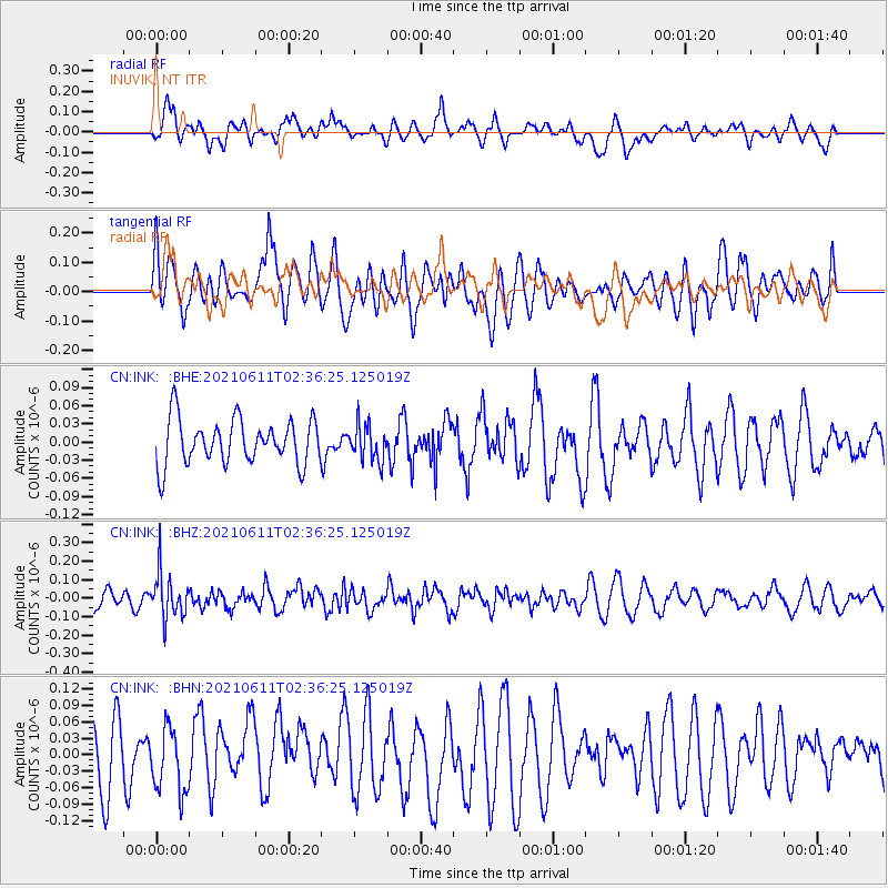
Signal To Noise
| Channel | StoN | STA | LTA |
| CN:INK: :BHZ:20210611T02:36:25.125019Z | 2.7408986 | 1.2047659E-7 | 4.3955144E-8 |
| CN:INK: :BHN:20210611T02:36:25.125019Z | 0.92312413 | 5.7962573E-8 | 6.2789574E-8 |
| CN:INK: :BHE:20210611T02:36:25.125019Z | 0.7895923 | 2.9315434E-8 | 3.7127304E-8 |
| Arrivals |
| Ps | |
| PpPs | |
| PsPs/PpSs | |


