You are here: Home > Network List > IU - Global Seismograph Network (GSN - IRIS/USGS) Stations List
> Station MAKZ Makanchi, Kazakhstan > Earthquake Result Viewer
MAKZ Makanchi, Kazakhstan - Earthquake Result Viewer

| Earthquake location: |
Eastern Gulf Of Aden |
| Earthquake latitude/longitude: |
12.8/48.6 |
| Earthquake time(UTC): |
2021/06/14 (165) 02:44:59 GMT |
| Earthquake Depth: |
10 km |
| Earthquake Magnitude: |
5.5 mww |
| Earthquake Catalog/Contributor: |
NEIC PDE/us |
|
| Network: |
IU Global Seismograph Network (GSN - IRIS/USGS) |
| Station: |
MAKZ Makanchi, Kazakhstan |
| Lat/Lon: |
46.81 N/81.98 E |
| Elevation: |
600 m |
|
| Distance: |
44.0 deg |
| Az: |
32.976 deg |
| Baz: |
230.615 deg |
| Ray Param: |
0.07220799 |
| Estimated Moho Depth: |
54.5 km |
| Estimated Crust Vp/Vs: |
1.72 |
| Assumed Crust Vp: |
6.571 km/s |
| Estimated Crust Vs: |
3.826 km/s |
| Estimated Crust Poisson's Ratio: |
0.24 |
|
| Radial Match: |
96.18924 % |
| Radial Bump: |
215 |
| Transverse Match: |
84.05142 % |
| Transverse Bump: |
400 |
| SOD ConfigId: |
25131211 |
| Insert Time: |
2021-06-28 02:48:45.709 +0000 |
| GWidth: |
2.5 |
| Max Bumps: |
400 |
| Tol: |
0.001 |
|
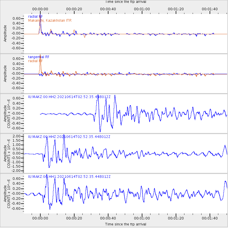
Signal To Noise
| Channel | StoN | STA | LTA |
| IU:MAKZ:00:HHZ:20210614T02:52:35.448012Z | 21.730007 | 7.796076E-7 | 3.5877008E-8 |
| IU:MAKZ:00:HH1:20210614T02:52:35.448012Z | 13.304799 | 3.096815E-7 | 2.3275923E-8 |
| IU:MAKZ:00:HH2:20210614T02:52:35.448012Z | 14.956088 | 3.1068603E-7 | 2.0773216E-8 |
| Arrivals |
| Ps | 6.4 SECOND |
| PpPs | 21 SECOND |
| PsPs/PpSs | 27 SECOND |


