You are here: Home > Network List > AV - Alaska Volcano Observatory Stations List
> Station MAPS Pakushin Southeast, Makushin Volcano, Alaska > Earthquake Result Viewer
MAPS Pakushin Southeast, Makushin Volcano, Alaska - Earthquake Result Viewer
*The percent match for this event was below the threshold and hence no stack was calculated.
| Earthquake location: |
Mindanao, Philippines |
| Earthquake latitude/longitude: |
7.7/125.0 |
| Earthquake time(UTC): |
2021/06/14 (165) 14:38:42 GMT |
| Earthquake Depth: |
10 km |
| Earthquake Magnitude: |
5.7 mww |
| Earthquake Catalog/Contributor: |
NEIC PDE/us |
|
| Network: |
AV Alaska Volcano Observatory |
| Station: |
MAPS Pakushin Southeast, Makushin Volcano, Alaska |
| Lat/Lon: |
53.81 N/166.94 W |
| Elevation: |
333 m |
|
| Distance: |
70.9 deg |
| Az: |
35.601 deg |
| Baz: |
256.607 deg |
| Ray Param: |
$rayparam |
*The percent match for this event was below the threshold and hence was not used in the summary stack. |
|
| Radial Match: |
64.40771 % |
| Radial Bump: |
400 |
| Transverse Match: |
61.117332 % |
| Transverse Bump: |
400 |
| SOD ConfigId: |
25131211 |
| Insert Time: |
2021-06-28 14:41:26.622 +0000 |
| GWidth: |
2.5 |
| Max Bumps: |
400 |
| Tol: |
0.001 |
|
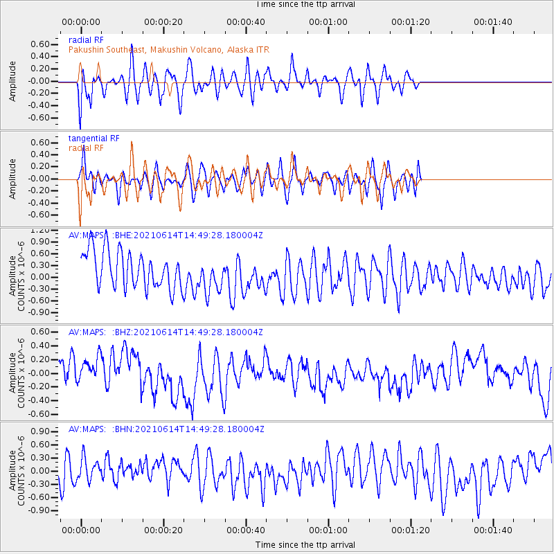
Signal To Noise
| Channel | StoN | STA | LTA |
| AV:MAPS: :BHZ:20210614T14:49:28.180004Z | 1.046064 | 2.7768954E-7 | 2.654613E-7 |
| AV:MAPS: :BHN:20210614T14:49:28.180004Z | 0.5358573 | 2.3997785E-7 | 4.478391E-7 |
| AV:MAPS: :BHE:20210614T14:49:28.180004Z | 0.9754643 | 4.5352792E-7 | 4.6493545E-7 |
| Arrivals |
| Ps | |
| PpPs | |
| PsPs/PpSs | |


