You are here: Home > Network List > CI - Caltech Regional Seismic Network Stations List
> Station MPM Manuel Prospect Mine, California, USA > Earthquake Result Viewer
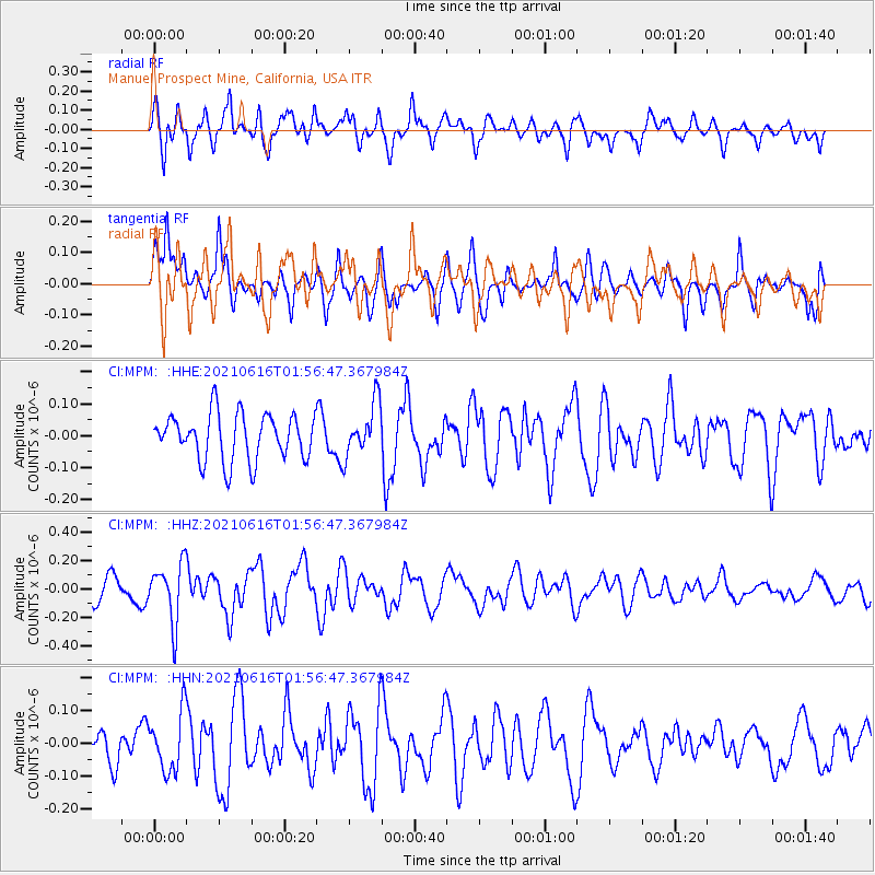
MPM Manuel Prospect Mine, California, USA - Earthquake Result Viewer
*The percent match for this event was below the threshold and hence no stack was calculated.
| Earthquake location: |
Kermadec Islands Region |
| Earthquake latitude/longitude: |
-31.6/-177.2 |
| Earthquake time(UTC): |
2021/06/16 (167) 01:44:30 GMT |
| Earthquake Depth: |
8.8 km |
| Earthquake Magnitude: |
5.3 Mww |
| Earthquake Catalog/Contributor: |
NEIC PDE/us |
|
| Network: |
CI Caltech Regional Seismic Network |
| Station: |
MPM Manuel Prospect Mine, California, USA |
| Lat/Lon: |
36.06 N/117.49 W |
| Elevation: |
185 m |
|
| Distance: |
87.5 deg |
| Az: |
44.431 deg |
| Baz: |
227.468 deg |
| Ray Param: |
$rayparam |
*The percent match for this event was below the threshold and hence was not used in the summary stack. |
|
| Radial Match: |
60.374638 % |
| Radial Bump: |
370 |
| Transverse Match: |
59.163128 % |
| Transverse Bump: |
400 |
| SOD ConfigId: |
25131211 |
| Insert Time: |
2021-06-30 01:49:52.975 +0000 |
| GWidth: |
2.5 |
| Max Bumps: |
400 |
| Tol: |
0.001 |
|
Signal To Noise
| Channel | StoN | STA | LTA |
| CI:MPM: :HHZ:20210616T01:56:47.367984Z | 2.2851582 | 2.071289E-7 | 9.064096E-8 |
| CI:MPM: :HHN:20210616T01:56:47.367984Z | 1.1509018 | 8.842396E-8 | 7.6830155E-8 |
| CI:MPM: :HHE:20210616T01:56:47.367984Z | 1.1493102 | 8.318972E-8 | 7.23823E-8 |
| Arrivals |
| Ps | |
| PpPs | |
| PsPs/PpSs | |


