You are here: Home > Network List > IU - Global Seismograph Network (GSN - IRIS/USGS) Stations List
> Station PMG Port Moresby, New Guinea > Earthquake Result Viewer
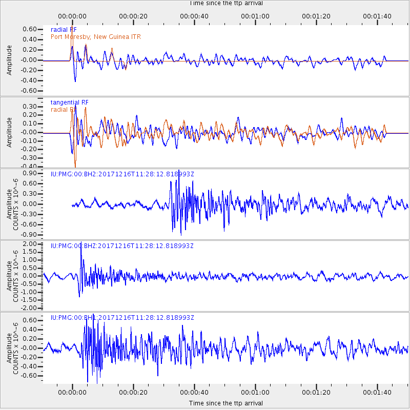
PMG Port Moresby, New Guinea - Earthquake Result Viewer
*The percent match for this event was below the threshold and hence no stack was calculated.
| Earthquake location: |
Fiji Islands Region |
| Earthquake latitude/longitude: |
-17.3/-177.5 |
| Earthquake time(UTC): |
2017/12/16 (350) 11:22:24 GMT |
| Earthquake Depth: |
391 km |
| Earthquake Magnitude: |
5.5 Mww |
| Earthquake Catalog/Contributor: |
NEIC PDE/us |
|
| Network: |
IU Global Seismograph Network (GSN - IRIS/USGS) |
| Station: |
PMG Port Moresby, New Guinea |
| Lat/Lon: |
9.40 S/147.16 E |
| Elevation: |
90 m |
|
| Distance: |
35.2 deg |
| Az: |
278.323 deg |
| Baz: |
106.707 deg |
| Ray Param: |
$rayparam |
*The percent match for this event was below the threshold and hence was not used in the summary stack. |
|
| Radial Match: |
56.755886 % |
| Radial Bump: |
400 |
| Transverse Match: |
57.91427 % |
| Transverse Bump: |
400 |
| SOD ConfigId: |
2429771 |
| Insert Time: |
2017-12-30 11:24:02.899 +0000 |
| GWidth: |
2.5 |
| Max Bumps: |
400 |
| Tol: |
0.001 |
|
Signal To Noise
| Channel | StoN | STA | LTA |
| IU:PMG:00:BHZ:20171216T11:28:12.818993Z | 6.5077653 | 6.357487E-7 | 9.769078E-8 |
| IU:PMG:00:BH1:20171216T11:28:12.818993Z | 2.707196 | 1.9680655E-7 | 7.269757E-8 |
| IU:PMG:00:BH2:20171216T11:28:12.818993Z | 5.5212383 | 3.5294576E-7 | 6.392511E-8 |
| Arrivals |
| Ps | |
| PpPs | |
| PsPs/PpSs | |


