You are here: Home > Network List > TA - USArray Transportable Network (new EarthScope stations) Stations List
> Station TUL3 Leonard, OK, USA > Earthquake Result Viewer
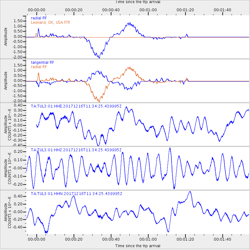
TUL3 Leonard, OK, USA - Earthquake Result Viewer
*The percent match for this event was below the threshold and hence no stack was calculated.
| Earthquake location: |
Fiji Islands Region |
| Earthquake latitude/longitude: |
-17.3/-177.5 |
| Earthquake time(UTC): |
2017/12/16 (350) 11:22:24 GMT |
| Earthquake Depth: |
391 km |
| Earthquake Magnitude: |
5.5 Mww |
| Earthquake Catalog/Contributor: |
NEIC PDE/us |
|
| Network: |
TA USArray Transportable Network (new EarthScope stations) |
| Station: |
TUL3 Leonard, OK, USA |
| Lat/Lon: |
35.91 N/95.79 W |
| Elevation: |
265 m |
|
| Distance: |
93.5 deg |
| Az: |
53.602 deg |
| Baz: |
251.271 deg |
| Ray Param: |
$rayparam |
*The percent match for this event was below the threshold and hence was not used in the summary stack. |
|
| Radial Match: |
56.74402 % |
| Radial Bump: |
400 |
| Transverse Match: |
47.36806 % |
| Transverse Bump: |
400 |
| SOD ConfigId: |
2429771 |
| Insert Time: |
2017-12-30 11:24:26.948 +0000 |
| GWidth: |
2.5 |
| Max Bumps: |
400 |
| Tol: |
0.001 |
|
Signal To Noise
| Channel | StoN | STA | LTA |
| TA:TUL3:01:HHZ:20171216T11:34:25.439995Z | 1.22353 | 1.2410665E-7 | 1.01433265E-7 |
| TA:TUL3:01:HHN:20171216T11:34:25.439995Z | 2.8736157 | 4.0245087E-7 | 1.4005033E-7 |
| TA:TUL3:01:HHE:20171216T11:34:25.439995Z | 4.432545 | 4.0779767E-7 | 9.2000796E-8 |
| Arrivals |
| Ps | |
| PpPs | |
| PsPs/PpSs | |


