You are here: Home > Network List > AV - Alaska Volcano Observatory Stations List
> Station AMKA Regional Station, Amchitka Island, Alaska > Earthquake Result Viewer
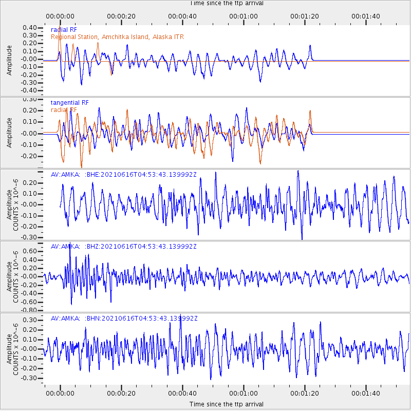
AMKA Regional Station, Amchitka Island, Alaska - Earthquake Result Viewer
*The percent match for this event was below the threshold and hence no stack was calculated.
| Earthquake location: |
Seram, Indonesia |
| Earthquake latitude/longitude: |
-3.6/129.5 |
| Earthquake time(UTC): |
2021/06/16 (167) 04:43:07 GMT |
| Earthquake Depth: |
5.7 km |
| Earthquake Magnitude: |
5.9 Mww |
| Earthquake Catalog/Contributor: |
NEIC PDE/us |
|
| Network: |
AV Alaska Volcano Observatory |
| Station: |
AMKA Regional Station, Amchitka Island, Alaska |
| Lat/Lon: |
51.38 N/179.30 E |
| Elevation: |
116 m |
|
| Distance: |
69.1 deg |
| Az: |
30.798 deg |
| Baz: |
234.626 deg |
| Ray Param: |
$rayparam |
*The percent match for this event was below the threshold and hence was not used in the summary stack. |
|
| Radial Match: |
57.910843 % |
| Radial Bump: |
396 |
| Transverse Match: |
63.461384 % |
| Transverse Bump: |
400 |
| SOD ConfigId: |
25131211 |
| Insert Time: |
2021-06-30 04:46:55.570 +0000 |
| GWidth: |
2.5 |
| Max Bumps: |
400 |
| Tol: |
0.001 |
|
Signal To Noise
| Channel | StoN | STA | LTA |
| AV:AMKA: :BHZ:20210616T04:53:43.139992Z | 3.9273639 | 2.5380848E-7 | 6.462565E-8 |
| AV:AMKA: :BHN:20210616T04:53:43.139992Z | 0.85233694 | 6.8357394E-8 | 8.019997E-8 |
| AV:AMKA: :BHE:20210616T04:53:43.139992Z | 1.1268294 | 9.9909414E-8 | 8.866419E-8 |
| Arrivals |
| Ps | |
| PpPs | |
| PsPs/PpSs | |


