You are here: Home > Network List > AZ - ANZA Regional Network Stations List
> Station SMER AZ.SMER > Earthquake Result Viewer
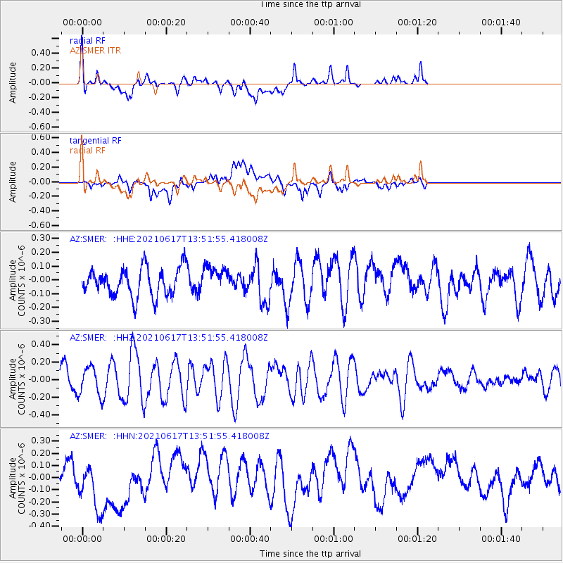
SMER AZ.SMER - Earthquake Result Viewer
*The percent match for this event was below the threshold and hence no stack was calculated.
| Earthquake location: |
Tonga Islands Region |
| Earthquake latitude/longitude: |
-17.2/-172.2 |
| Earthquake time(UTC): |
2021/06/17 (168) 13:40:58 GMT |
| Earthquake Depth: |
10 km |
| Earthquake Magnitude: |
5.3 mww |
| Earthquake Catalog/Contributor: |
NEIC PDE/us |
|
| Network: |
AZ ANZA Regional Network |
| Station: |
SMER AZ.SMER |
| Lat/Lon: |
33.46 N/117.17 W |
| Elevation: |
355 m |
|
| Distance: |
72.7 deg |
| Az: |
45.828 deg |
| Baz: |
235.113 deg |
| Ray Param: |
$rayparam |
*The percent match for this event was below the threshold and hence was not used in the summary stack. |
|
| Radial Match: |
63.056877 % |
| Radial Bump: |
400 |
| Transverse Match: |
39.753723 % |
| Transverse Bump: |
400 |
| SOD ConfigId: |
25131211 |
| Insert Time: |
2021-07-01 13:44:47.260 +0000 |
| GWidth: |
2.5 |
| Max Bumps: |
400 |
| Tol: |
0.001 |
|
Signal To Noise
| Channel | StoN | STA | LTA |
| AZ:SMER: :HHZ:20210617T13:51:55.418008Z | 1.2845538 | 1.6175942E-7 | 1.2592655E-7 |
| AZ:SMER: :HHN:20210617T13:51:55.418008Z | 1.6816443 | 2.2073418E-7 | 1.3126093E-7 |
| AZ:SMER: :HHE:20210617T13:51:55.418008Z | 0.9374104 | 9.574347E-8 | 1.0213613E-7 |
| Arrivals |
| Ps | |
| PpPs | |
| PsPs/PpSs | |


