You are here: Home > Network List > AK - Alaska Regional Network Stations List
> Station MDM Murphy Dome > Earthquake Result Viewer
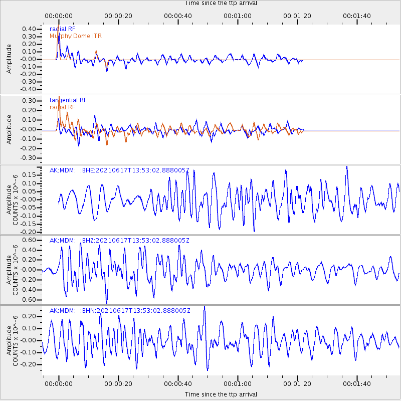
MDM Murphy Dome - Earthquake Result Viewer
*The percent match for this event was below the threshold and hence no stack was calculated.
| Earthquake location: |
Tonga Islands Region |
| Earthquake latitude/longitude: |
-17.2/-172.8 |
| Earthquake time(UTC): |
2021/06/17 (168) 13:41:03 GMT |
| Earthquake Depth: |
10 km |
| Earthquake Magnitude: |
5.5 mww |
| Earthquake Catalog/Contributor: |
NEIC PDE/us |
|
| Network: |
AK Alaska Regional Network |
| Station: |
MDM Murphy Dome |
| Lat/Lon: |
64.96 N/148.23 W |
| Elevation: |
634 m |
|
| Distance: |
84.1 deg |
| Az: |
10.242 deg |
| Baz: |
203.532 deg |
| Ray Param: |
$rayparam |
*The percent match for this event was below the threshold and hence was not used in the summary stack. |
|
| Radial Match: |
74.966034 % |
| Radial Bump: |
307 |
| Transverse Match: |
72.004265 % |
| Transverse Bump: |
367 |
| SOD ConfigId: |
25131211 |
| Insert Time: |
2021-07-01 14:01:07.899 +0000 |
| GWidth: |
2.5 |
| Max Bumps: |
400 |
| Tol: |
0.001 |
|
Signal To Noise
| Channel | StoN | STA | LTA |
| AK:MDM: :BHZ:20210617T13:53:02.888005Z | 4.2926135 | 3.1037916E-7 | 7.2305404E-8 |
| AK:MDM: :BHN:20210617T13:53:02.888005Z | 1.7492917 | 1.10116275E-7 | 6.294906E-8 |
| AK:MDM: :BHE:20210617T13:53:02.888005Z | 0.8969875 | 4.866428E-8 | 5.4253018E-8 |
| Arrivals |
| Ps | |
| PpPs | |
| PsPs/PpSs | |


