You are here: Home > Network List > AZ - ANZA Regional Network Stations List
> Station SMER AZ.SMER > Earthquake Result Viewer
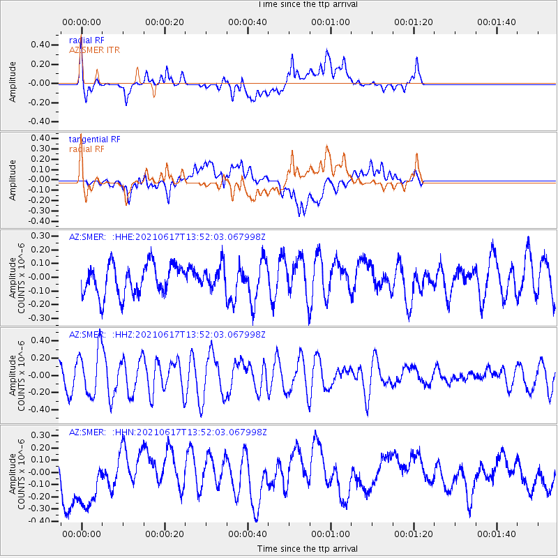
SMER AZ.SMER - Earthquake Result Viewer
*The percent match for this event was below the threshold and hence no stack was calculated.
| Earthquake location: |
Tonga Islands Region |
| Earthquake latitude/longitude: |
-17.2/-172.8 |
| Earthquake time(UTC): |
2021/06/17 (168) 13:41:03 GMT |
| Earthquake Depth: |
10 km |
| Earthquake Magnitude: |
5.5 mww |
| Earthquake Catalog/Contributor: |
NEIC PDE/us |
|
| Network: |
AZ ANZA Regional Network |
| Station: |
SMER AZ.SMER |
| Lat/Lon: |
33.46 N/117.17 W |
| Elevation: |
355 m |
|
| Distance: |
73.2 deg |
| Az: |
46.119 deg |
| Baz: |
235.484 deg |
| Ray Param: |
$rayparam |
*The percent match for this event was below the threshold and hence was not used in the summary stack. |
|
| Radial Match: |
68.76798 % |
| Radial Bump: |
400 |
| Transverse Match: |
39.350548 % |
| Transverse Bump: |
400 |
| SOD ConfigId: |
25131211 |
| Insert Time: |
2021-07-01 14:03:48.527 +0000 |
| GWidth: |
2.5 |
| Max Bumps: |
400 |
| Tol: |
0.001 |
|
Signal To Noise
| Channel | StoN | STA | LTA |
| AZ:SMER: :HHZ:20210617T13:52:03.067998Z | 1.8663331 | 2.7061012E-7 | 1.449956E-7 |
| AZ:SMER: :HHN:20210617T13:52:03.067998Z | 3.0039248 | 2.551846E-7 | 8.495039E-8 |
| AZ:SMER: :HHE:20210617T13:52:03.067998Z | 0.7681036 | 8.600917E-8 | 1.1197601E-7 |
| Arrivals |
| Ps | |
| PpPs | |
| PsPs/PpSs | |


