You are here: Home > Network List > CI - Caltech Regional Seismic Network Stations List
> Station DAN Danby, California, USA > Earthquake Result Viewer
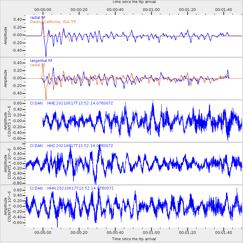
DAN Danby, California, USA - Earthquake Result Viewer
*The percent match for this event was below the threshold and hence no stack was calculated.
| Earthquake location: |
Tonga Islands Region |
| Earthquake latitude/longitude: |
-17.2/-172.8 |
| Earthquake time(UTC): |
2021/06/17 (168) 13:41:03 GMT |
| Earthquake Depth: |
10 km |
| Earthquake Magnitude: |
5.5 mww |
| Earthquake Catalog/Contributor: |
NEIC PDE/us |
|
| Network: |
CI Caltech Regional Seismic Network |
| Station: |
DAN Danby, California, USA |
| Lat/Lon: |
34.64 N/115.38 W |
| Elevation: |
398 m |
|
| Distance: |
75.1 deg |
| Az: |
45.971 deg |
| Baz: |
236.441 deg |
| Ray Param: |
$rayparam |
*The percent match for this event was below the threshold and hence was not used in the summary stack. |
|
| Radial Match: |
69.62131 % |
| Radial Bump: |
400 |
| Transverse Match: |
64.276855 % |
| Transverse Bump: |
400 |
| SOD ConfigId: |
25131211 |
| Insert Time: |
2021-07-01 14:05:49.375 +0000 |
| GWidth: |
2.5 |
| Max Bumps: |
400 |
| Tol: |
0.001 |
|
Signal To Noise
| Channel | StoN | STA | LTA |
| CI:DAN: :HHZ:20210617T13:52:14.078007Z | 1.3814311 | 1.9733447E-7 | 1.4284787E-7 |
| CI:DAN: :HHN:20210617T13:52:14.078007Z | 1.5104403 | 2.3374913E-7 | 1.5475563E-7 |
| CI:DAN: :HHE:20210617T13:52:14.078007Z | 1.3361719 | 1.878809E-7 | 1.4061133E-7 |
| Arrivals |
| Ps | |
| PpPs | |
| PsPs/PpSs | |


