You are here: Home > Network List > IU - Global Seismograph Network (GSN - IRIS/USGS) Stations List
> Station PMG Port Moresby, New Guinea > Earthquake Result Viewer
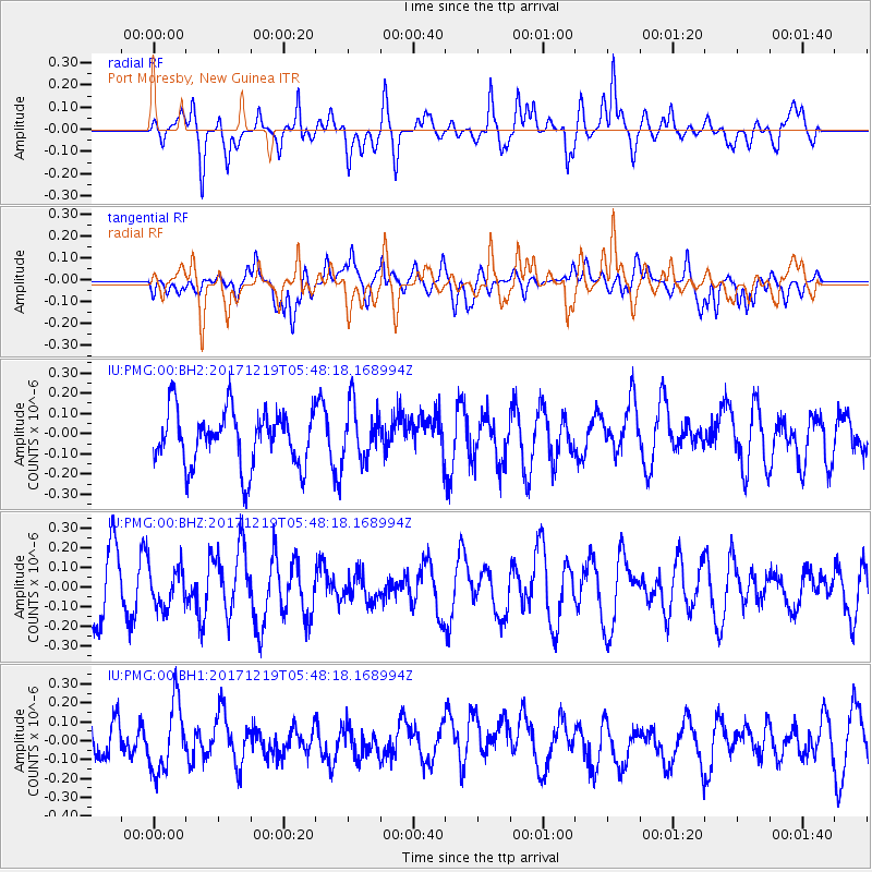
PMG Port Moresby, New Guinea - Earthquake Result Viewer
*The percent match for this event was below the threshold and hence no stack was calculated.
| Earthquake location: |
Southern East Pacific Rise |
| Earthquake latitude/longitude: |
-21.9/-114.2 |
| Earthquake time(UTC): |
2017/12/19 (353) 05:35:29 GMT |
| Earthquake Depth: |
10 km |
| Earthquake Magnitude: |
5.6 mb |
| Earthquake Catalog/Contributor: |
NEIC PDE/us |
|
| Network: |
IU Global Seismograph Network (GSN - IRIS/USGS) |
| Station: |
PMG Port Moresby, New Guinea |
| Lat/Lon: |
9.40 S/147.16 E |
| Elevation: |
90 m |
|
| Distance: |
94.4 deg |
| Az: |
258.108 deg |
| Baz: |
112.95 deg |
| Ray Param: |
$rayparam |
*The percent match for this event was below the threshold and hence was not used in the summary stack. |
|
| Radial Match: |
58.372105 % |
| Radial Bump: |
400 |
| Transverse Match: |
43.44502 % |
| Transverse Bump: |
400 |
| SOD ConfigId: |
2429771 |
| Insert Time: |
2018-01-02 05:37:32.380 +0000 |
| GWidth: |
2.5 |
| Max Bumps: |
400 |
| Tol: |
0.001 |
|
Signal To Noise
| Channel | StoN | STA | LTA |
| IU:PMG:00:BHZ:20171219T05:48:18.168994Z | 0.784442 | 1.0107743E-7 | 1.2885266E-7 |
| IU:PMG:00:BH1:20171219T05:48:18.168994Z | 1.7674994 | 1.8424905E-7 | 1.0424277E-7 |
| IU:PMG:00:BH2:20171219T05:48:18.168994Z | 0.9764169 | 1.3349826E-7 | 1.367226E-7 |
| Arrivals |
| Ps | |
| PpPs | |
| PsPs/PpSs | |


