You are here: Home > Network List > G - GEOSCOPE Stations List
> Station INU Inuyama, Japan > Earthquake Result Viewer
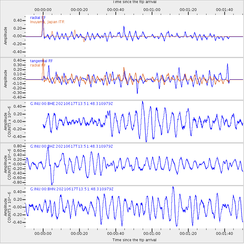
INU Inuyama, Japan - Earthquake Result Viewer
*The percent match for this event was below the threshold and hence no stack was calculated.
| Earthquake location: |
Tonga Islands Region |
| Earthquake latitude/longitude: |
-17.2/-172.8 |
| Earthquake time(UTC): |
2021/06/17 (168) 13:41:03 GMT |
| Earthquake Depth: |
10 km |
| Earthquake Magnitude: |
5.5 mww |
| Earthquake Catalog/Contributor: |
NEIC PDE/us |
|
| Network: |
G GEOSCOPE |
| Station: |
INU Inuyama, Japan |
| Lat/Lon: |
35.35 N/137.03 E |
| Elevation: |
132 m |
|
| Distance: |
70.7 deg |
| Az: |
318.291 deg |
| Baz: |
128.937 deg |
| Ray Param: |
$rayparam |
*The percent match for this event was below the threshold and hence was not used in the summary stack. |
|
| Radial Match: |
67.413025 % |
| Radial Bump: |
400 |
| Transverse Match: |
78.91774 % |
| Transverse Bump: |
400 |
| SOD ConfigId: |
25131211 |
| Insert Time: |
2021-07-01 14:07:59.264 +0000 |
| GWidth: |
2.5 |
| Max Bumps: |
400 |
| Tol: |
0.001 |
|
Signal To Noise
| Channel | StoN | STA | LTA |
| G:INU:00:BHZ:20210617T13:51:48.310979Z | 1.6535771 | 3.9390935E-7 | 2.382165E-7 |
| G:INU:00:BHN:20210617T13:51:48.310979Z | 0.70359445 | 1.1522644E-7 | 1.6376826E-7 |
| G:INU:00:BHE:20210617T13:51:48.310979Z | 0.8251011 | 8.2072155E-8 | 9.946921E-8 |
| Arrivals |
| Ps | |
| PpPs | |
| PsPs/PpSs | |


