You are here: Home > Network List > US - United States National Seismic Network Stations List
> Station EGMT Eagleton, Montana, USA > Earthquake Result Viewer
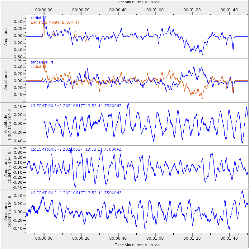
EGMT Eagleton, Montana, USA - Earthquake Result Viewer
*The percent match for this event was below the threshold and hence no stack was calculated.
| Earthquake location: |
Tonga Islands Region |
| Earthquake latitude/longitude: |
-17.2/-172.8 |
| Earthquake time(UTC): |
2021/06/17 (168) 13:41:03 GMT |
| Earthquake Depth: |
10 km |
| Earthquake Magnitude: |
5.5 mww |
| Earthquake Catalog/Contributor: |
NEIC PDE/us |
|
| Network: |
US United States National Seismic Network |
| Station: |
EGMT Eagleton, Montana, USA |
| Lat/Lon: |
48.02 N/109.75 W |
| Elevation: |
1055 m |
|
| Distance: |
85.8 deg |
| Az: |
36.86 deg |
| Baz: |
238.647 deg |
| Ray Param: |
$rayparam |
*The percent match for this event was below the threshold and hence was not used in the summary stack. |
|
| Radial Match: |
47.908714 % |
| Radial Bump: |
400 |
| Transverse Match: |
46.305668 % |
| Transverse Bump: |
400 |
| SOD ConfigId: |
25131211 |
| Insert Time: |
2021-07-01 14:16:13.710 +0000 |
| GWidth: |
2.5 |
| Max Bumps: |
400 |
| Tol: |
0.001 |
|
Signal To Noise
| Channel | StoN | STA | LTA |
| US:EGMT:00:BHZ:20210617T13:53:11.750004Z | 1.8977679 | 1.252203E-7 | 6.598294E-8 |
| US:EGMT:00:BH1:20210617T13:53:11.750004Z | 2.4086773 | 3.015256E-7 | 1.2518306E-7 |
| US:EGMT:00:BH2:20210617T13:53:11.750004Z | 1.1005608 | 1.5023204E-7 | 1.36505E-7 |
| Arrivals |
| Ps | |
| PpPs | |
| PsPs/PpSs | |


