You are here: Home > Network List > TX - Texas Seismological Network Stations List
> Station WTFS Witchita Falls > Earthquake Result Viewer
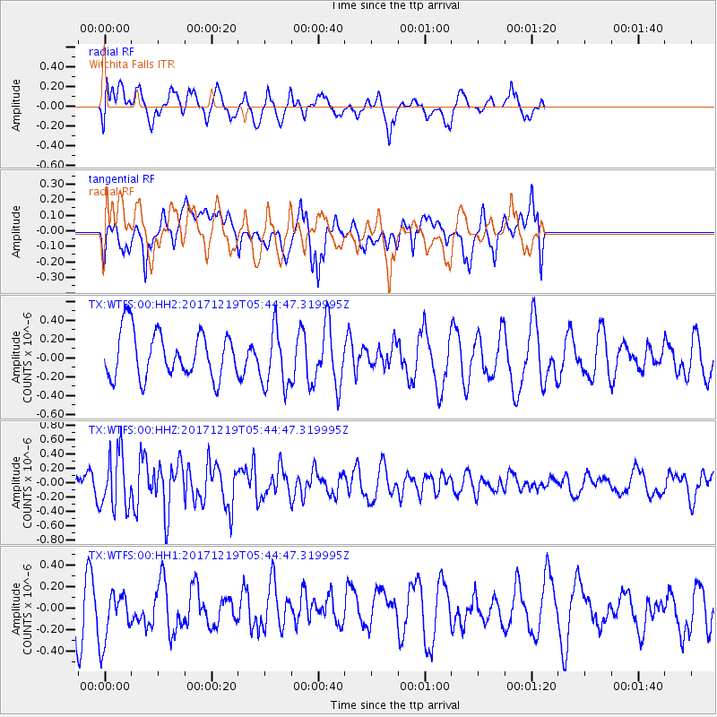
WTFS Witchita Falls - Earthquake Result Viewer
*The percent match for this event was below the threshold and hence no stack was calculated.
| Earthquake location: |
Southern East Pacific Rise |
| Earthquake latitude/longitude: |
-21.9/-114.2 |
| Earthquake time(UTC): |
2017/12/19 (353) 05:35:29 GMT |
| Earthquake Depth: |
10 km |
| Earthquake Magnitude: |
5.6 mb |
| Earthquake Catalog/Contributor: |
NEIC PDE/us |
|
| Network: |
TX Texas Seismological Network |
| Station: |
WTFS Witchita Falls |
| Lat/Lon: |
33.77 N/98.46 W |
| Elevation: |
277 m |
|
| Distance: |
57.4 deg |
| Az: |
15.607 deg |
| Baz: |
197.45 deg |
| Ray Param: |
$rayparam |
*The percent match for this event was below the threshold and hence was not used in the summary stack. |
|
| Radial Match: |
62.177414 % |
| Radial Bump: |
400 |
| Transverse Match: |
50.71891 % |
| Transverse Bump: |
400 |
| SOD ConfigId: |
2429771 |
| Insert Time: |
2018-01-02 05:39:09.806 +0000 |
| GWidth: |
2.5 |
| Max Bumps: |
400 |
| Tol: |
0.001 |
|
Signal To Noise
| Channel | StoN | STA | LTA |
| TX:WTFS:00:HHZ:20171219T05:44:47.319995Z | 1.9817241 | 3.8882496E-7 | 1.962054E-7 |
| TX:WTFS:00:HH1:20171219T05:44:47.319995Z | 1.3237834 | 2.5255818E-7 | 1.9078513E-7 |
| TX:WTFS:00:HH2:20171219T05:44:47.319995Z | 1.277829 | 3.118499E-7 | 2.4404665E-7 |
| Arrivals |
| Ps | |
| PpPs | |
| PsPs/PpSs | |


