You are here: Home > Network List > US - United States National Seismic Network Stations List
> Station WUAZ Wupatki, Arizona, USA > Earthquake Result Viewer
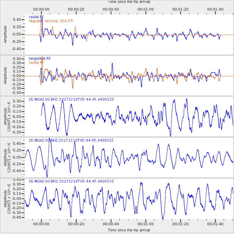
WUAZ Wupatki, Arizona, USA - Earthquake Result Viewer
*The percent match for this event was below the threshold and hence no stack was calculated.
| Earthquake location: |
Southern East Pacific Rise |
| Earthquake latitude/longitude: |
-21.9/-114.2 |
| Earthquake time(UTC): |
2017/12/19 (353) 05:35:29 GMT |
| Earthquake Depth: |
10 km |
| Earthquake Magnitude: |
5.6 mb |
| Earthquake Catalog/Contributor: |
NEIC PDE/us |
|
| Network: |
US United States National Seismic Network |
| Station: |
WUAZ Wupatki, Arizona, USA |
| Lat/Lon: |
35.52 N/111.37 W |
| Elevation: |
1592 m |
|
| Distance: |
57.2 deg |
| Az: |
2.791 deg |
| Baz: |
183.177 deg |
| Ray Param: |
$rayparam |
*The percent match for this event was below the threshold and hence was not used in the summary stack. |
|
| Radial Match: |
46.351772 % |
| Radial Bump: |
400 |
| Transverse Match: |
65.7949 % |
| Transverse Bump: |
400 |
| SOD ConfigId: |
2429771 |
| Insert Time: |
2018-01-02 05:39:58.593 +0000 |
| GWidth: |
2.5 |
| Max Bumps: |
400 |
| Tol: |
0.001 |
|
Signal To Noise
| Channel | StoN | STA | LTA |
| US:WUAZ:00:BHZ:20171219T05:44:45.949023Z | 2.4991252 | 3.2908883E-7 | 1.316816E-7 |
| US:WUAZ:00:BH1:20171219T05:44:45.949023Z | 1.3744384 | 1.3844932E-7 | 1.00731555E-7 |
| US:WUAZ:00:BH2:20171219T05:44:45.949023Z | 0.38697985 | 6.391569E-8 | 1.6516543E-7 |
| Arrivals |
| Ps | |
| PpPs | |
| PsPs/PpSs | |


