You are here: Home > Network List > CN - Canadian National Seismograph Network Stations List
> Station INK INUVIK, NT > Earthquake Result Viewer
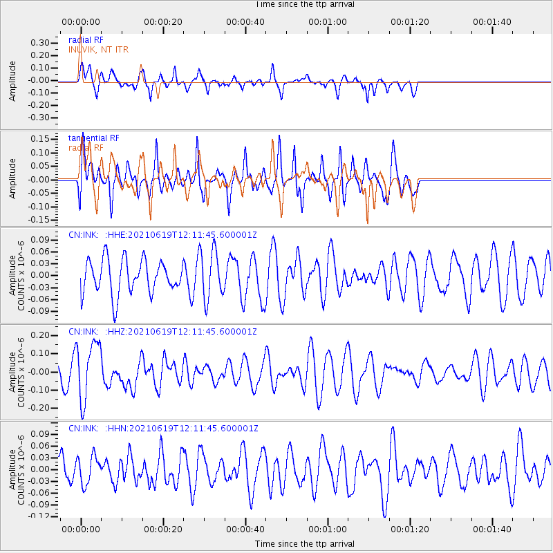
INK INUVIK, NT - Earthquake Result Viewer
*The percent match for this event was below the threshold and hence no stack was calculated.
| Earthquake location: |
Fiji Islands Region |
| Earthquake latitude/longitude: |
-16.4/173.1 |
| Earthquake time(UTC): |
2021/06/19 (170) 11:59:05 GMT |
| Earthquake Depth: |
10 km |
| Earthquake Magnitude: |
5.8 mww |
| Earthquake Catalog/Contributor: |
NEIC PDE/us |
|
| Network: |
CN Canadian National Seismograph Network |
| Station: |
INK INUVIK, NT |
| Lat/Lon: |
68.31 N/133.53 W |
| Elevation: |
44 m |
|
| Distance: |
92.7 deg |
| Az: |
17.378 deg |
| Baz: |
230.464 deg |
| Ray Param: |
$rayparam |
*The percent match for this event was below the threshold and hence was not used in the summary stack. |
|
| Radial Match: |
41.287014 % |
| Radial Bump: |
257 |
| Transverse Match: |
55.581543 % |
| Transverse Bump: |
350 |
| SOD ConfigId: |
25131211 |
| Insert Time: |
2021-07-03 12:09:50.657 +0000 |
| GWidth: |
2.5 |
| Max Bumps: |
400 |
| Tol: |
0.001 |
|
Signal To Noise
| Channel | StoN | STA | LTA |
| CN:INK: :HHZ:20210619T12:11:45.600001Z | 2.1415937 | 1.6255895E-7 | 7.59056E-8 |
| CN:INK: :HHN:20210619T12:11:45.600001Z | 0.6970859 | 3.649935E-8 | 5.2359905E-8 |
| CN:INK: :HHE:20210619T12:11:45.600001Z | 1.4380296 | 6.13541E-8 | 4.2665395E-8 |
| Arrivals |
| Ps | |
| PpPs | |
| PsPs/PpSs | |


