You are here: Home > Network List > G - GEOSCOPE Stations List
> Station CLF Chambon la Foret observatory, France > Earthquake Result Viewer
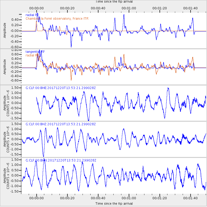
CLF Chambon la Foret observatory, France - Earthquake Result Viewer
*The percent match for this event was below the threshold and hence no stack was calculated.
| Earthquake location: |
Southeast Of Shikoku, Japan |
| Earthquake latitude/longitude: |
30.6/132.1 |
| Earthquake time(UTC): |
2017/12/20 (354) 13:40:54 GMT |
| Earthquake Depth: |
10 km |
| Earthquake Magnitude: |
5.5 Mww |
| Earthquake Catalog/Contributor: |
NEIC PDE/us |
|
| Network: |
G GEOSCOPE |
| Station: |
CLF Chambon la Foret observatory, France |
| Lat/Lon: |
48.03 N/2.26 E |
| Elevation: |
145 m |
|
| Distance: |
89.7 deg |
| Az: |
328.957 deg |
| Baz: |
41.468 deg |
| Ray Param: |
$rayparam |
*The percent match for this event was below the threshold and hence was not used in the summary stack. |
|
| Radial Match: |
58.70564 % |
| Radial Bump: |
400 |
| Transverse Match: |
67.471695 % |
| Transverse Bump: |
400 |
| SOD ConfigId: |
2429771 |
| Insert Time: |
2018-01-03 13:41:30.233 +0000 |
| GWidth: |
2.5 |
| Max Bumps: |
400 |
| Tol: |
0.001 |
|
Signal To Noise
| Channel | StoN | STA | LTA |
| G:CLF:00:BHZ:20171220T13:53:21.299028Z | 3.1109283 | 7.18416E-7 | 2.3093301E-7 |
| G:CLF:00:BHN:20171220T13:53:21.299028Z | 1.9168596 | 9.159749E-7 | 4.778518E-7 |
| G:CLF:00:BHE:20171220T13:53:21.299028Z | 1.996896 | 9.3975206E-7 | 4.706064E-7 |
| Arrivals |
| Ps | |
| PpPs | |
| PsPs/PpSs | |


