You are here: Home > Network List > PF - Volcanologic Network of Piton de Fournaise-OVPF Stations List
> Station HIM cratere Himiltrude > Earthquake Result Viewer
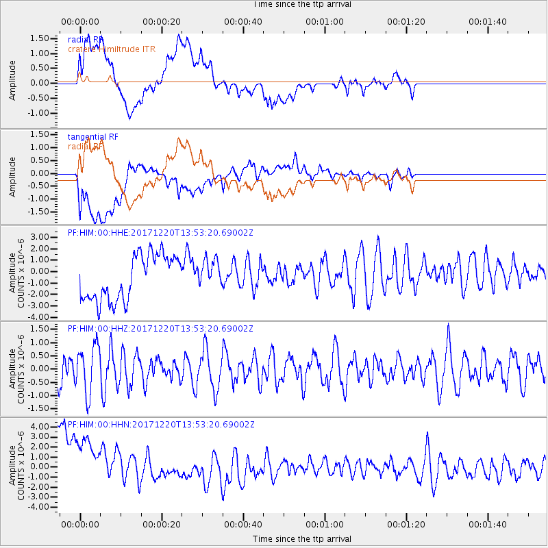
HIM cratere Himiltrude - Earthquake Result Viewer
*The percent match for this event was below the threshold and hence no stack was calculated.
| Earthquake location: |
Southeast Of Shikoku, Japan |
| Earthquake latitude/longitude: |
30.6/132.1 |
| Earthquake time(UTC): |
2017/12/20 (354) 13:40:54 GMT |
| Earthquake Depth: |
10 km |
| Earthquake Magnitude: |
5.5 Mww |
| Earthquake Catalog/Contributor: |
NEIC PDE/us |
|
| Network: |
PF Volcanologic Network of Piton de Fournaise-OVPF |
| Station: |
HIM cratere Himiltrude |
| Lat/Lon: |
21.21 S/55.72 E |
| Elevation: |
1958 m |
|
| Distance: |
89.6 deg |
| Az: |
245.058 deg |
| Baz: |
56.896 deg |
| Ray Param: |
$rayparam |
*The percent match for this event was below the threshold and hence was not used in the summary stack. |
|
| Radial Match: |
28.250164 % |
| Radial Bump: |
400 |
| Transverse Match: |
33.939434 % |
| Transverse Bump: |
400 |
| SOD ConfigId: |
2429771 |
| Insert Time: |
2018-01-03 13:42:59.022 +0000 |
| GWidth: |
2.5 |
| Max Bumps: |
400 |
| Tol: |
0.001 |
|
Signal To Noise
| Channel | StoN | STA | LTA |
| PF:HIM:00:HHZ:20171220T13:53:20.69002Z | 1.7832018 | 9.122141E-7 | 5.115596E-7 |
| PF:HIM:00:HHN:20171220T13:53:20.69002Z | 1.1917062 | 4.761088E-6 | 3.995186E-6 |
| PF:HIM:00:HHE:20171220T13:53:20.69002Z | 0.64513445 | 1.2693021E-6 | 1.9675E-6 |
| Arrivals |
| Ps | |
| PpPs | |
| PsPs/PpSs | |


