You are here: Home > Network List > GS - US Geological Survey Networks Stations List
> Station KAN10 Keim Farm > Earthquake Result Viewer
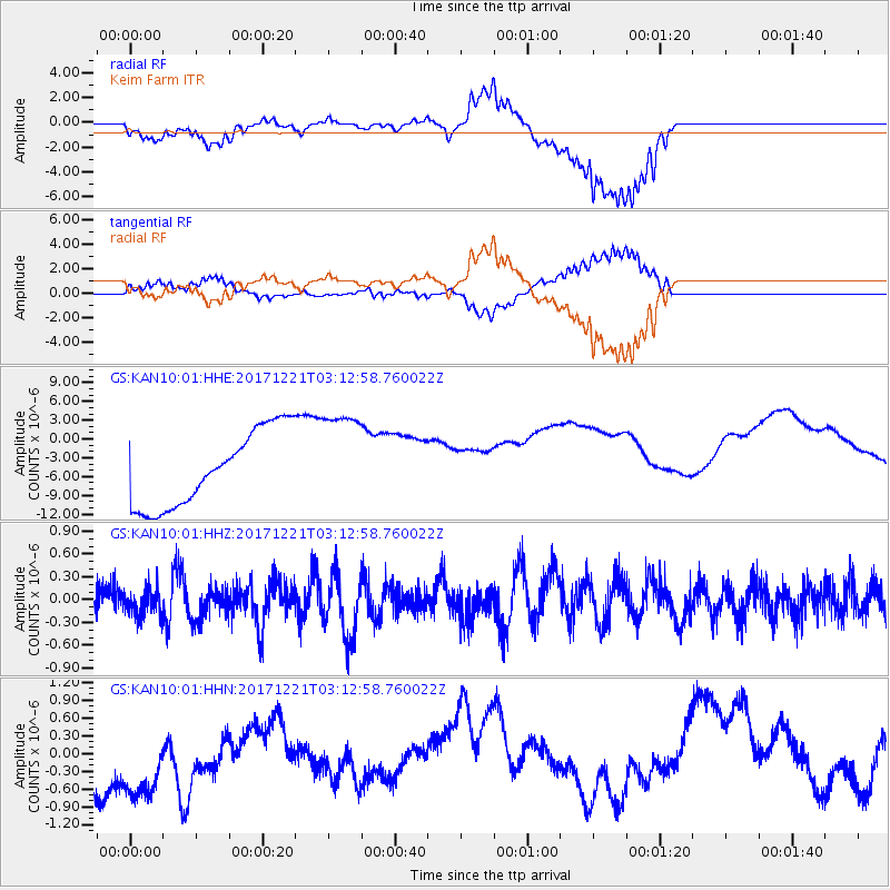
KAN10 Keim Farm - Earthquake Result Viewer
*The percent match for this event was below the threshold and hence no stack was calculated.
| Earthquake location: |
Southeast Of Honshu, Japan |
| Earthquake latitude/longitude: |
29.3/142.7 |
| Earthquake time(UTC): |
2017/12/21 (355) 03:00:19 GMT |
| Earthquake Depth: |
16 km |
| Earthquake Magnitude: |
5.7 Mww |
| Earthquake Catalog/Contributor: |
NEIC PDE/us |
|
| Network: |
GS US Geological Survey Networks |
| Station: |
KAN10 Keim Farm |
| Lat/Lon: |
37.12 N/98.10 W |
| Elevation: |
417 m |
|
| Distance: |
92.8 deg |
| Az: |
44.317 deg |
| Baz: |
310.22 deg |
| Ray Param: |
$rayparam |
*The percent match for this event was below the threshold and hence was not used in the summary stack. |
|
| Radial Match: |
40.426636 % |
| Radial Bump: |
278 |
| Transverse Match: |
39.38528 % |
| Transverse Bump: |
299 |
| SOD ConfigId: |
2429771 |
| Insert Time: |
2018-01-04 03:01:24.255 +0000 |
| GWidth: |
2.5 |
| Max Bumps: |
400 |
| Tol: |
0.001 |
|
Signal To Noise
| Channel | StoN | STA | LTA |
| GS:KAN10:01:HHZ:20171221T03:12:58.760022Z | 1.0187161 | 1.9525372E-7 | 1.9166647E-7 |
| GS:KAN10:01:HHN:20171221T03:12:58.760022Z | 1.3465064 | 1.3812673E-6 | 1.0258157E-6 |
| GS:KAN10:01:HHE:20171221T03:12:58.760022Z | 1.360139 | 8.185327E-6 | 6.0180078E-6 |
| Arrivals |
| Ps | |
| PpPs | |
| PsPs/PpSs | |


