You are here: Home > Network List > AV - Alaska Volcano Observatory Stations List
> Station PLBL Mt. Peulik Volcano, Alaska > Earthquake Result Viewer
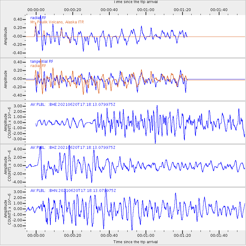
PLBL Mt. Peulik Volcano, Alaska - Earthquake Result Viewer
*The percent match for this event was below the threshold and hence no stack was calculated.
| Earthquake location: |
Kermadec Islands, New Zealand |
| Earthquake latitude/longitude: |
-30.2/-177.8 |
| Earthquake time(UTC): |
2021/06/20 (171) 17:05:48 GMT |
| Earthquake Depth: |
10 km |
| Earthquake Magnitude: |
6.5 mww |
| Earthquake Catalog/Contributor: |
NEIC PDE/us |
|
| Network: |
AV Alaska Volcano Observatory |
| Station: |
PLBL Mt. Peulik Volcano, Alaska |
| Lat/Lon: |
57.70 N/156.82 W |
| Elevation: |
461 m |
|
| Distance: |
89.3 deg |
| Az: |
11.09 deg |
| Baz: |
198.066 deg |
| Ray Param: |
$rayparam |
*The percent match for this event was below the threshold and hence was not used in the summary stack. |
|
| Radial Match: |
80.14125 % |
| Radial Bump: |
400 |
| Transverse Match: |
73.9068 % |
| Transverse Bump: |
400 |
| SOD ConfigId: |
25131211 |
| Insert Time: |
2021-07-04 17:12:53.894 +0000 |
| GWidth: |
2.5 |
| Max Bumps: |
400 |
| Tol: |
0.001 |
|
Signal To Noise
| Channel | StoN | STA | LTA |
| AV:PLBL: :BHZ:20210620T17:18:13.079975Z | 9.841573 | 2.0970826E-6 | 2.1308408E-7 |
| AV:PLBL: :BHN:20210620T17:18:13.079975Z | 1.7398875 | 5.831612E-7 | 3.3517176E-7 |
| AV:PLBL: :BHE:20210620T17:18:13.079975Z | 1.7215852 | 7.24069E-7 | 4.2058275E-7 |
| Arrivals |
| Ps | |
| PpPs | |
| PsPs/PpSs | |


