You are here: Home > Network List > GS - US Geological Survey Networks Stations List
> Station KAN10 Keim Farm > Earthquake Result Viewer
KAN10 Keim Farm - Earthquake Result Viewer
*The percent match for this event was below the threshold and hence no stack was calculated.
| Earthquake location: |
Near East Coast Of Kamchatka |
| Earthquake latitude/longitude: |
53.8/160.5 |
| Earthquake time(UTC): |
2017/12/22 (356) 14:44:17 GMT |
| Earthquake Depth: |
46 km |
| Earthquake Magnitude: |
5.4 Mww |
| Earthquake Catalog/Contributor: |
NEIC PDE/us |
|
| Network: |
GS US Geological Survey Networks |
| Station: |
KAN10 Keim Farm |
| Lat/Lon: |
37.12 N/98.10 W |
| Elevation: |
417 m |
|
| Distance: |
67.0 deg |
| Az: |
58.343 deg |
| Baz: |
320.863 deg |
| Ray Param: |
$rayparam |
*The percent match for this event was below the threshold and hence was not used in the summary stack. |
|
| Radial Match: |
41.10137 % |
| Radial Bump: |
400 |
| Transverse Match: |
39.05728 % |
| Transverse Bump: |
400 |
| SOD ConfigId: |
2429771 |
| Insert Time: |
2018-01-05 14:45:48.817 +0000 |
| GWidth: |
2.5 |
| Max Bumps: |
400 |
| Tol: |
0.001 |
|
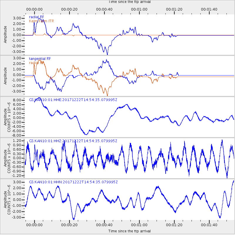
Signal To Noise
| Channel | StoN | STA | LTA |
| GS:KAN10:01:HHZ:20171222T14:54:35.079995Z | 0.97643566 | 4.1576294E-7 | 4.2579657E-7 |
| GS:KAN10:01:HHN:20171222T14:54:35.079995Z | 1.8325025 | 1.5971962E-6 | 8.715929E-7 |
| GS:KAN10:01:HHE:20171222T14:54:35.079995Z | 3.3605802 | 9.768899E-6 | 2.9069083E-6 |
| Arrivals |
| Ps | |
| PpPs | |
| PsPs/PpSs | |


